 Remote Sensing
Remote Sensing
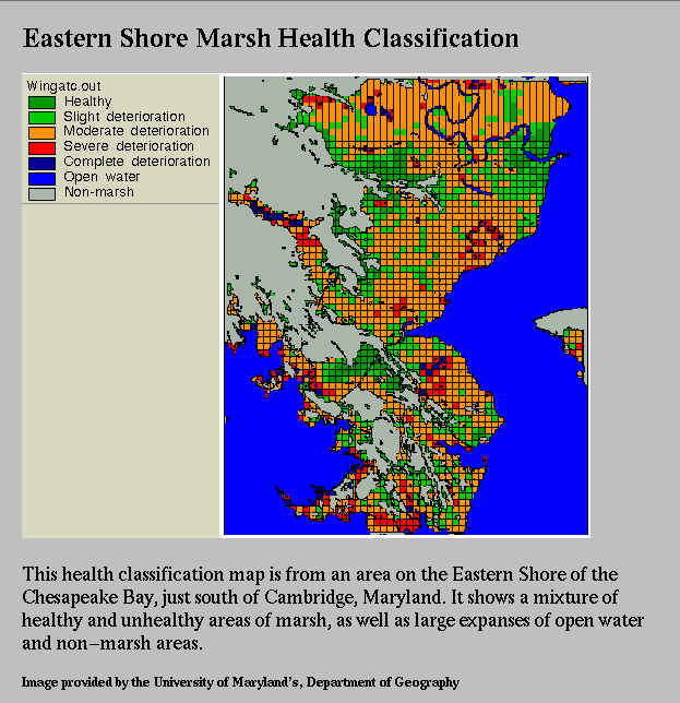
Remote Sensing Pollution and land loss from agriculture, industry, urbanization, relative sea level rise and exotic species disturbance has resulted in the drastic reduction of populations of many species that have been supported by the sheltered, biologically rich environment provided by marshes. A comprehensive picture of the distribution and diversity of vegetation habitat types in the region and regular monitoring of spatial and temporal change, may reveal patterns that will provide insight into the cause of ecosystem disturbance and decline and will help in identifying regions requiring immediate analysis and mitigation.
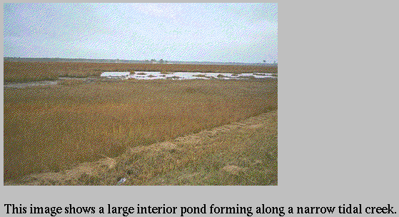
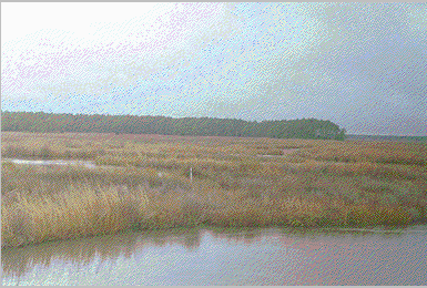
Data on the number, distribution and shapes of interior marsh ponds (usually only a few meters in diameter when forming) and their rates of change will be valuable in determining the mechanism by which the marshes are dying. This information is used for a generalized health classification which can then focus local efforts on problem solving.
Regular monitoring of the shoreline and the distribution and extent of interior marsh ponds is extremely important in determining the land loss process in the Blackwater area. NOAA's Coastal Change Analysis Project (CCAP) has used Landsat Thematic Mapper (TM) data to compile a map showing the types and extent of vegetation in the Chesapeake Bay area for 1988 .
CCAP has plans to generate a similar image in the future to investigate change in the region. Unfortunately, the pixel resolution of Landsat data is too large (30 meters) to be able to monitor the subtle ecosystem variability that may be indicative of the land loss process. Occasionally, arial photographs will be taken for this an other tasks. These will have the resolution to monitor changes in marsh ponds and other aspects of this ecosystem.
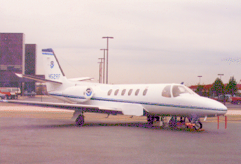
As an example of the kind of equipment used in airborne photogrammetry, the associated photo shows the NGS Cessna Citation II Fanjet aircraft. This airplane is equipped with a Wild RC-20 forward-motion compensated camera and a Wild RC-10 camera with 9"x9" format. Images obtained with this equipment include: