 False color image showing the Estuarine and Palustrine Emergent vegetation
types around the Chesapeake Bay for 1988/1989. This image was created
by identifying land and vegetation types from Landsat Thematic Mapper images.
The different catagories were then color coded and this false color image
created. The identifying colors have been subdued except for emergent wetlands
to accentuate these categories.
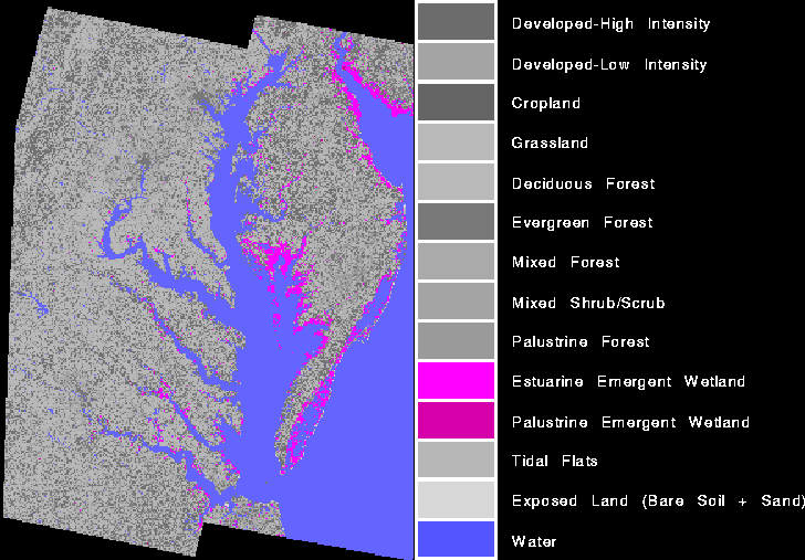
False color image showing the Estuarine and Palustrine Emergent vegetation
types around the Chesapeake Bay for 1988/1989. This image was created
by identifying land and vegetation types from Landsat Thematic Mapper images.
The different catagories were then color coded and this false color image
created. The identifying colors have been subdued except for emergent wetlands
to accentuate these categories.