- Lt. Col. Thomas Lincoln Casey, 1885
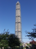
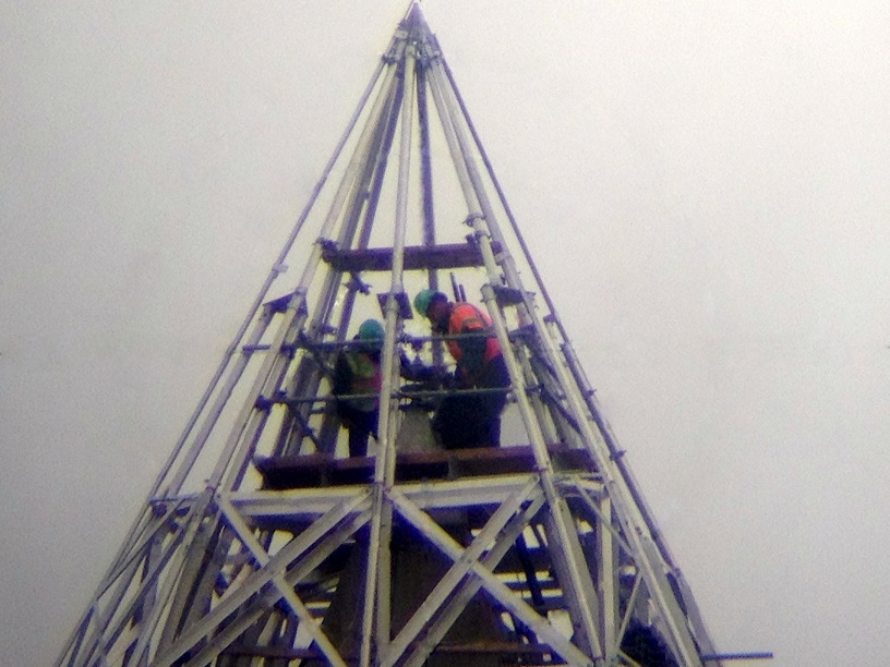
A rare 5.8-magnitude earthquake struck the Piedmont region of Virginia on August 23, 2011, shaking the Nation’s capital with sufficient force to crack stones and loosen mortar in the Washington Monument (WM). Scaffolding built around the structure to facilitate repairs made to the building in 2013 and 2014 provided a rare opportunity for NOAA’s National Geodetic Survey (NGS) to perform a geodetic survey incorporating direct occupation of the WM peak with multiple instruments. A brief history of surveys at the Washington Monument
The primary results of this new survey are:
- NGS verified the 1885 architectural height of 555' 5 1/8 inches to within 3/4 of an inch.
- NGS computed a new architectural height of the Washington Monument using the CTBUH standard as:
- 554 feet 7 and 11/32 inches +/- 1/32 inches, which is the same as
- 169.046 meters +/- 1.0 millimeters
- NGS positioned the peak of the Washington Monument in the National Spatial Reference System (NSRS) as:
| Coordinate Type | Value | Standard Deviation | Datum |
| Latitude | N 38° 53’ 22.08257” | 2.0 mm | NAD 83(2011) |
| Longitude | W 77° 02’ 06.86428” | 1.0 mm | NAD 83(2011) |
| Ellipsoid Height | 149.172 m m | 1.0 mm | NAD 83(2011) |
| Orthometric Height | 181.261 m | 1.0 mm | NAVD 88 |
Click here for information as to why these new measurements disagree with historical values
In the future, it may be useful to know if the peak of the monument is changing in any way, and all these measurements, if performed accurately again in the future, could help make this determination. For instance, if the monument were sinking, the elevation of the peak would be expected to change. If it were shrinking (compressing under its own weight) the architectural height would be expected to change. If it were tilting, the latitude or longitude (or both) would be expected to change. Of these possible changes, only the issue of sinking has been validated through repeated geodetic leveling to points at the base of the monument. At this time, the monument’s base is known to be sinking at a rate of about 0.5 millimeters per year, based on an analysis of leveling performed over the last century.
No historic surveys were of sufficient accuracy to state whether any of the other changes have occurred between them and 2014. NGS hopes this new 2013–2014 survey will stand as a baseline for future surveys of the peak and that a comparison of surveys will allow for change detection at the peak.

