 Calibration Base Line (CBL) Map

Welcome to the EDMI Calibration Base Line (CBL) Map. The map provides quick and easy access to the latest CBL information available to NOAA's National Geodetic Survey.
NGS HomeCalibration Base Line Program
Three ways to locate a CBL
- Zoom in to a specific location using your mouse.
- Use the Geographic Location Search box below to search by location.
- Use the Search tool to the right of the contents panel to search by CBL Identification Code.
Geographic Location Search
Search by location or decimal coordinates (lat/lon). An X is placed at the location entered.
Symbology
Symobology represents the current condition of the CBL
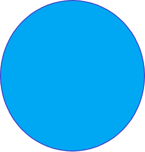
GOOD
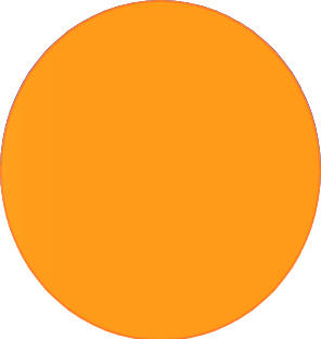
SUSPECT
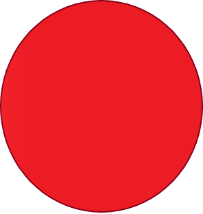
DISTURBED
Notice:
Boundary representation is not necessarily authoritative
Map Last Updated: May 6, 2019
Help
Help Notes:
- Mouse wheel and buttons on top left of menu will zoom in and out of map
- Click markers to see information
- Click on the search to search for a particular CBL ID
CBL Symbology Definitions
- Good: No reported issues.
- Suspect: An unverified issue has been reported.
- Disturbed: A verified issue has been reported.