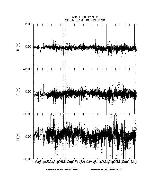
GPS
The GPS equipment was installed in 1994 in the R.V. Truitt Lab, a three
story masonry building adjacent to the CBL pier. A
site log containing a history of GPS equipment at this site is available through the
data center.
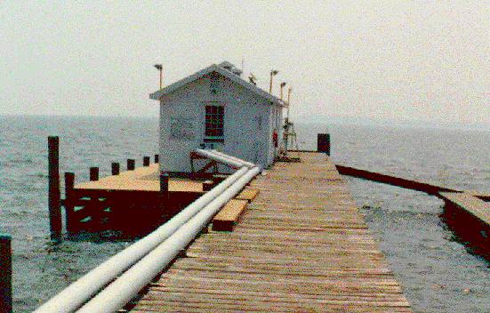
The Dorne Margolin antenna with T type choke rings is mounted on the roof
above the stair well.

The antenna rests on a 1 meter square aluminum groundplane fixed into the roof
of the stairwell with bolts. The antenna itself is not connected to the roof.


The data are downloaded daily to NOAA. The raw and RINEX data
files are accessible via anonymous ftp from the
Geosciences Research Division's Data Center.
The observations are dual frequency with a 30 second tracking interval and a
15° observation elevation cutoff.