 Subsidence
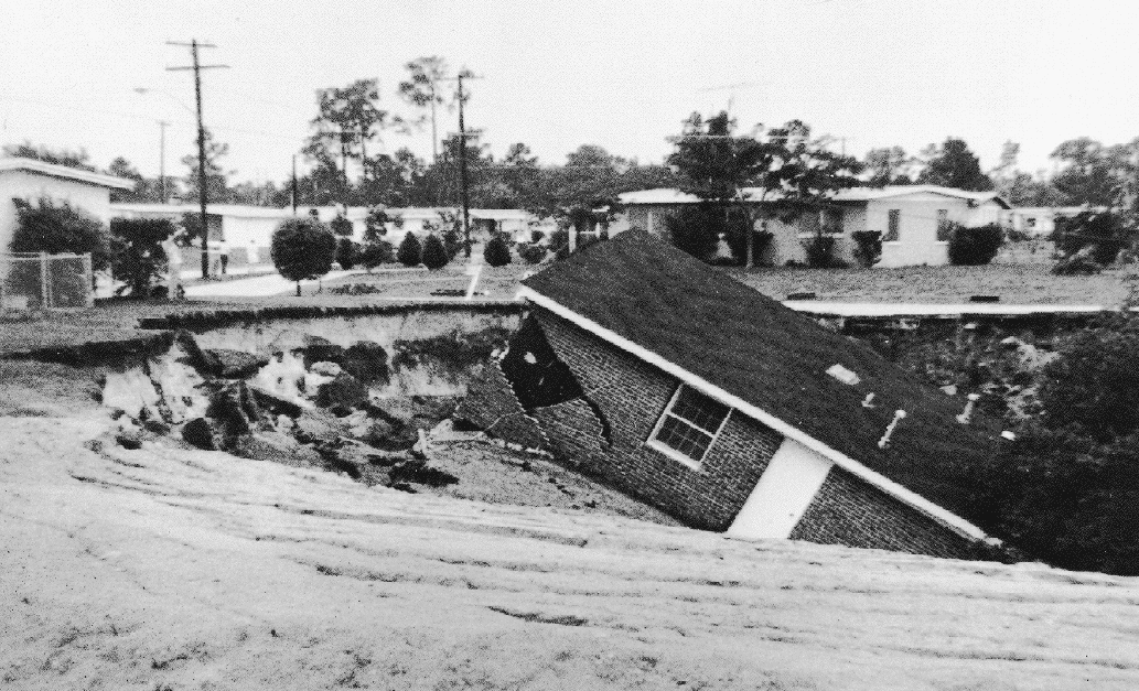
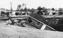
Subsidence of a residence in Florida (USGS photo)
Tide gauges in the Chesapeake Bay indicate that sea level there is rising at twice the global average. However since tide gauges are a relative measure of sea level height (see Variations in Sea Level), it is impossible to discern a sea level rise from land subsidence. To resolve this ambiguity, we are installing GPS receivers in the Chesapeake Bay region. The GPS receivers will monitor the absolute motion of the crust in this region (see GPS Section of this document).
Land subsidence, in the Chesapeake Bay region, may result from
- sediment loading or
- sediment compaction following groundwater extraction.
Sediment Loading
The Chesapeake Bay is a depositional basin that is being filled by sediment
- transported by rivers
- derived from the continental shelf
- and caused by shoreline erosion.
Groundwater Extraction
The Maryland Geologic Survey's Department of Hydrology has been monitoring wells in the area surrounding the Chesapeake Bay since the 1940's [Frederick Mack, personal communication]. Annual maps displaying the depth of the water table (see Figure 2 for an example) of the Aquia Aquifer in Southern Maryland, indicate that the surface of the water table has dropped on average by approximately 10 meters [Curtin et al., 1980-1991]. Specific wells display drops of as much as two to five times that amount. Ground subsidence is expected to result from the subsequent compaction of the aquifer. We would expect to see a larger subsidence in the GPS data near areas of maximum water withdrawal as opposed to areas distant from pumping stations.