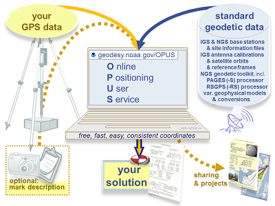
NOAA's Online Positioning User Service (OPUS) provides free access to high-accuracy National Spatial Reference System (NSRS) coordinates. OPUS uses the same software which computes coordinates for the nation's geodetic control marks and the NOAA CORS Network (NCN).
To use OPUS, simply upload a GPS data file (collected with a survey-grade GPS receiver) to the OPUS upload page. Your computed NSRS position will be emailed to you. If you choose, your position can also be shared publicly on the NGS website, or added to a larger survey project.
Helpful resources: