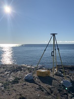
OPUS Projects provides simple management
and processing tools for your survey projects involving multiple sites and
multiple occupations. Advantages include:
If you're interested in submitting your project's results for publication in
the NGS Integrated Database (IDB) and have not done so, please visit the
NGS Survey Project Proposal web site to
request a required project tracking number. In addition, for publication all survey marks must be described by creating description files in NGS software WinDesc.
- Customizable data processing via the PAGES software suite
- Visualization and management aids
- Adjustments tied to the National Spatial Reference System
| Learn More: |
[ ✓ ] NEW! v.5.3.0 UPGRADE COMPLETE
NEW UPDATE
OPUS Projects has been successfully updated to work in the new International Terrestrial Reference Frame of 2020 (ITRF2020). For projects created before this update that are in ITRF2014, users will not be able to process sessions. If all sessions were processed before the ITRF2020 rollout, users will be able to run network adjustments in the ITRF2014 frame. If all sessions were not processed before the ITRF2020 rollout, users must create new projects in ITRF2020 and reload their data via OPUS-S.
OPUS Projects has been successfully updated to work in the new International Terrestrial Reference Frame of 2020 (ITRF2020). For projects created before this update that are in ITRF2014, users will not be able to process sessions. If all sessions were processed before the ITRF2020 rollout, users will be able to run network adjustments in the ITRF2014 frame. If all sessions were not processed before the ITRF2020 rollout, users must create new projects in ITRF2020 and reload their data via OPUS-S.
| Create a new project. | ||
| RESTRICTED to trained project managers. If you have completed OPUS Projects training, you are registered and may create a new project. All others, see the Training Schedule. | ||


