Requirements for Using OPUS-Projects 5 in the 2023 GPSonBM Campaign
Introduction
This web page provides details on collecting data on published marks to support the 2023 GPSonBM campaign using a Real-Time GNSS Network (RTN). Data can then be processed, adjusted, and submitted to NGS using OPUS-Projects 5. Results will be reviewed by NGS with the intent of loading into its national database. The information below aims to take advantage of the efficiency of real-time kinematic GNSS surveying while maintaining sufficient data quality for future geodetic modeling purposes.
Please carefully read through the information below. Note it is limited to the 2023 GPSonBM campaign and will be replaced, or superseded, when NGS finishes its new GNSS surveying specifications.
Project Planning
Plan to collect data on multiple marks in a single network. While your field time will be greatly reduced by using an RTN to collect 5 minute occupations instead of the 4 hour occupations required for OPUS Share, your office time will moderately increase. Higher gains will be achieved by measuring multiple marks in a single project instead of sharing single occupations on only one mark.
You do not need to create a separate file/job for each mark in your field software, but project duration is a factor. We recommend projects in a file/job do not exceed 30 days from the start to finish of field data collection.
Prior to collecting any data and after deciding which bench marks to include, submit a
Survey Proposal. NGS will then provide feedback and send
a project tracking ID. Consult the
OPUS-Projects User Guide for an example
as well as detailed guidance on running the software.
Equipment and Configuration
When selecting equipment, verify that its software is capable of exporting measurements in the GNSS Vector Exchange (GVX) format. NGS does not provide tools for converting proprietary data file formats to GVX. As a Federal entity we do not endorse any specific companies, although we are aware that Trimble[1], Topcon[2], Javad[3] and Leica[4] software currently support exporting data in GVX format. Test exporting GNSS vectors to GVX in your software, and upload the test GVX file to OPUS-Projects 5 before conducting any surveys.
Apply the following settings to each selected rover connected to the RTN:
- Log all GNSS constellations supported by both the receiver and the RTN
- Ensure the receipt of full network real-time correctors from the RTN. Examples include Trimble's Virtual Reference Station (VRS) corrections or Leica's Master-Auxiliary Concept (MAX, iMAX) corrections.
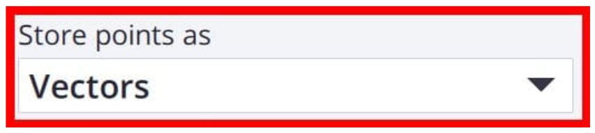
- If using Trimble VRS corrections, you must ensure you log vectors to a physical reference station (PRS). In Trimble Access software, setup your
Rover Options to "Store points as" Vectors.
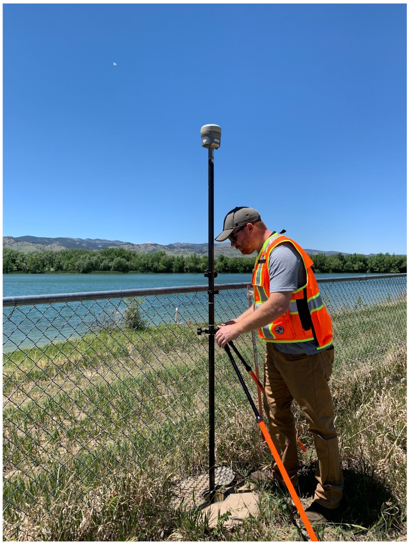
Use a fixed-height tripod (preferred) or a solid bipod with a fixed-height rod
Field Requirements
Before any RTN data collection, first establish an RTN Validation Station. Recover a mark and collect at least two static GNSS occupations, minimum of 2 hours each. The static data must be uploaded into OPUS-Projects and will be used to validate your RTN measurements.
During the RTN survey, measure each mark in your project (including the RTN Validation Station) for a minimum of 5 minutes for 3 independent occupations. All 3 measurements must agree by 3 cm Horizontal and 5 cm Ellipsoid Height. They also must be separated by at least 3 hours (even if occupied on different days). Plan to occupy a mark, go occupy a few more in the area, then circle back. Or rotate day-by-day.
While onsite at each mark, use the occupation time to:
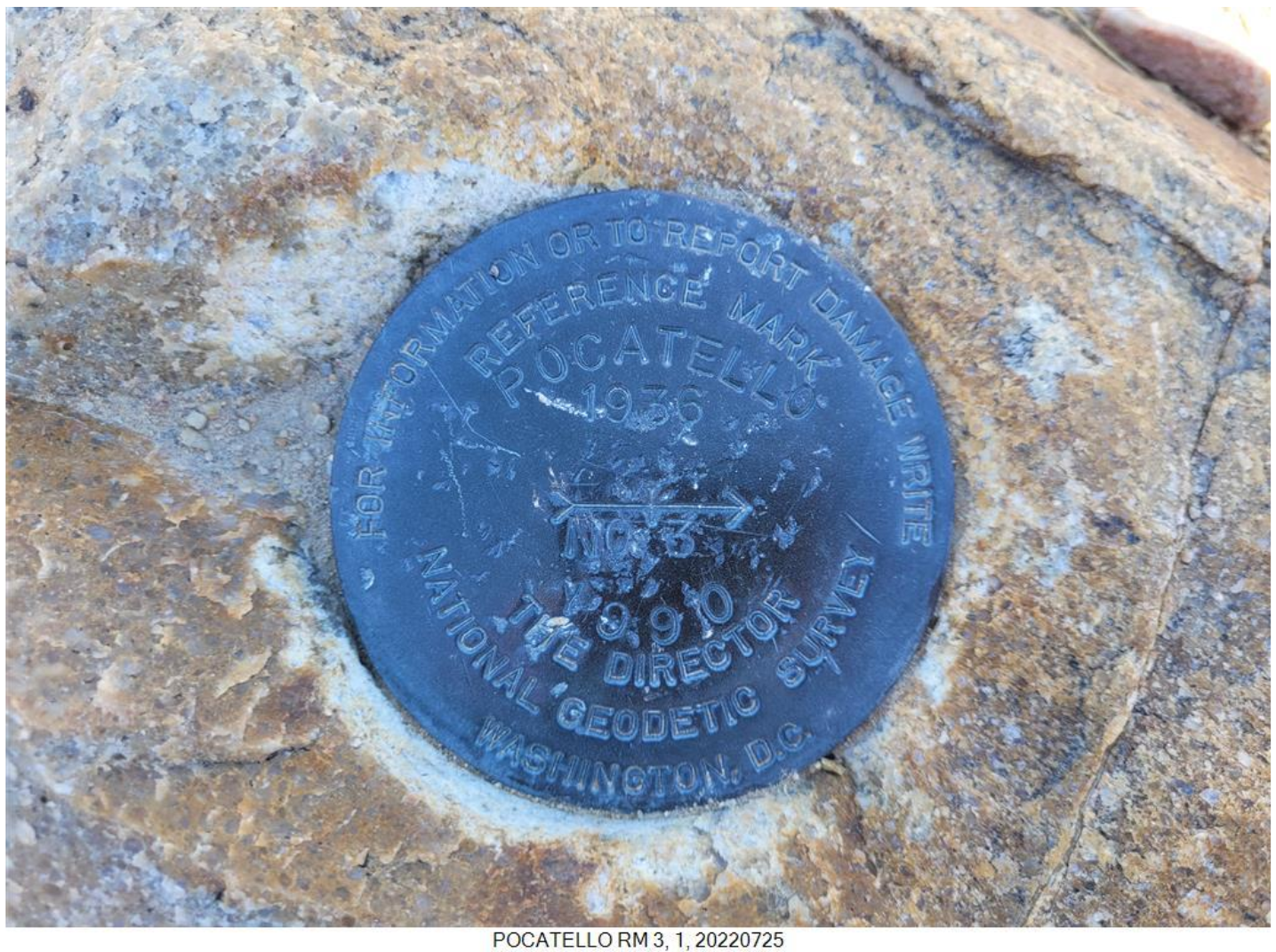
- Confirm that the existing NGS Datasheet description is correct, up-to-date, and sufficient to locate the mark. If not, draft a new description or updates to the existing description that you will later input to WinDesc as recovery text.
- Collect 3 photos of each mark: 1 close-up with stamping clearly shown; 1 looking downward from eye level; 1 horizon photo preferably showing the tripod/bipod and antenna setup
- Fill out a simple log for each observation (suggest to use the OPUS Share field log)
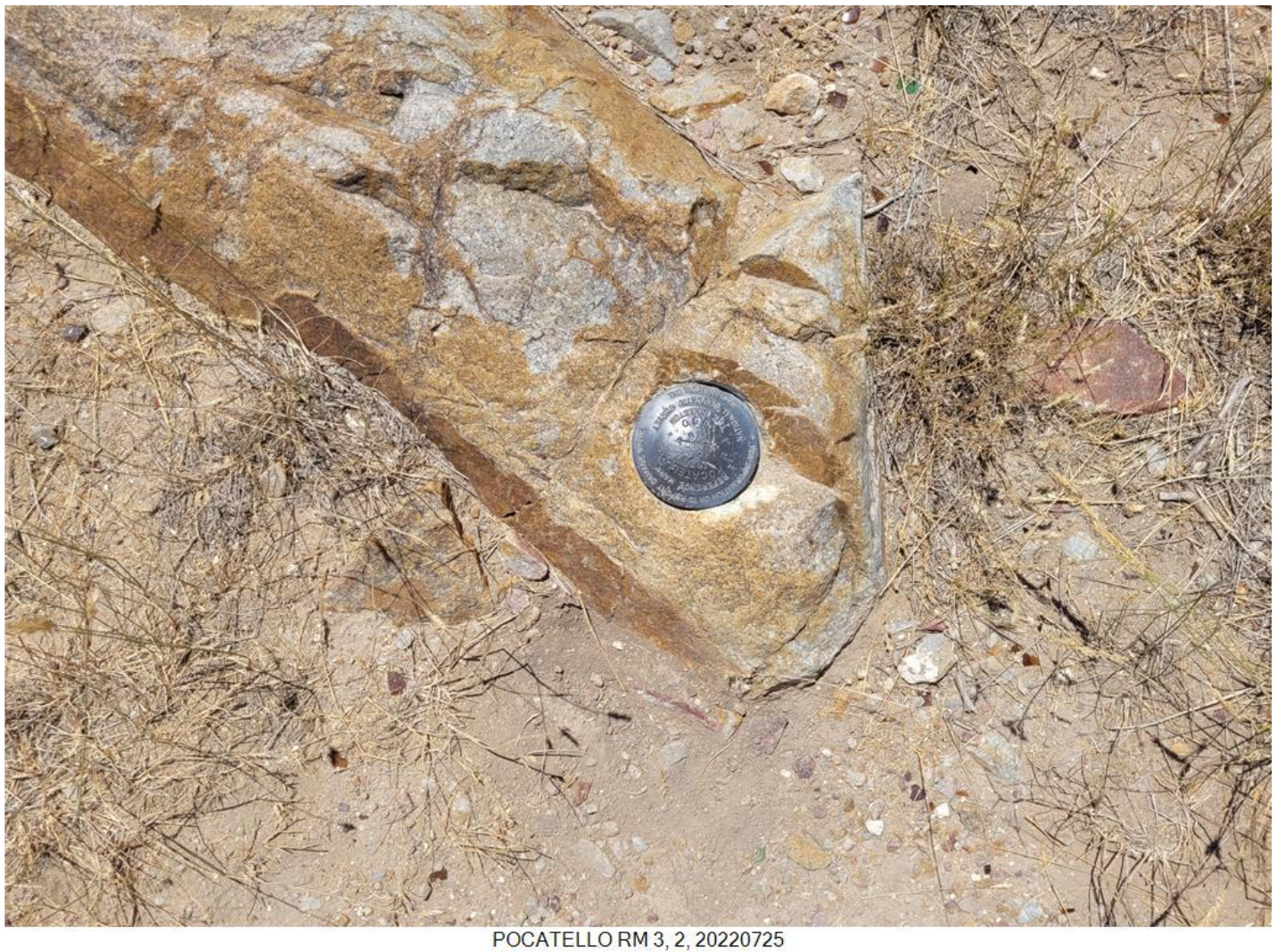
Close-up Photo
Eye-level Photo
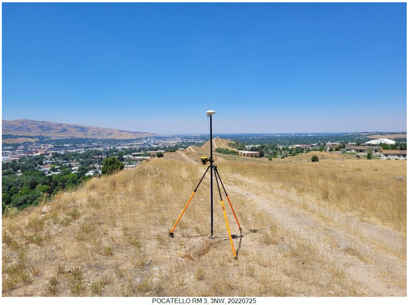
Horizon Photo
Office Requirements
Use your equipment's software to review, organize, and export the appropriate GNSS vectors to GVX file(s). Confirm the following are included: antenna model & serial number and receiver model & serial number for all rovers and bases.
Next, for each utilized base station that is not part of the NOAA CORS Network (NCN), download the static GNSS data files (in RINEX format) from your RTN provider. Gather a minimum of three full day (24-hour) data files at each base station, and ensure that the data also overlap in time with the days of the RTN measurements. It is not necessary to download or gather data files for base stations that are part of the NCN because the data for those stations will be automatically included in your Project.
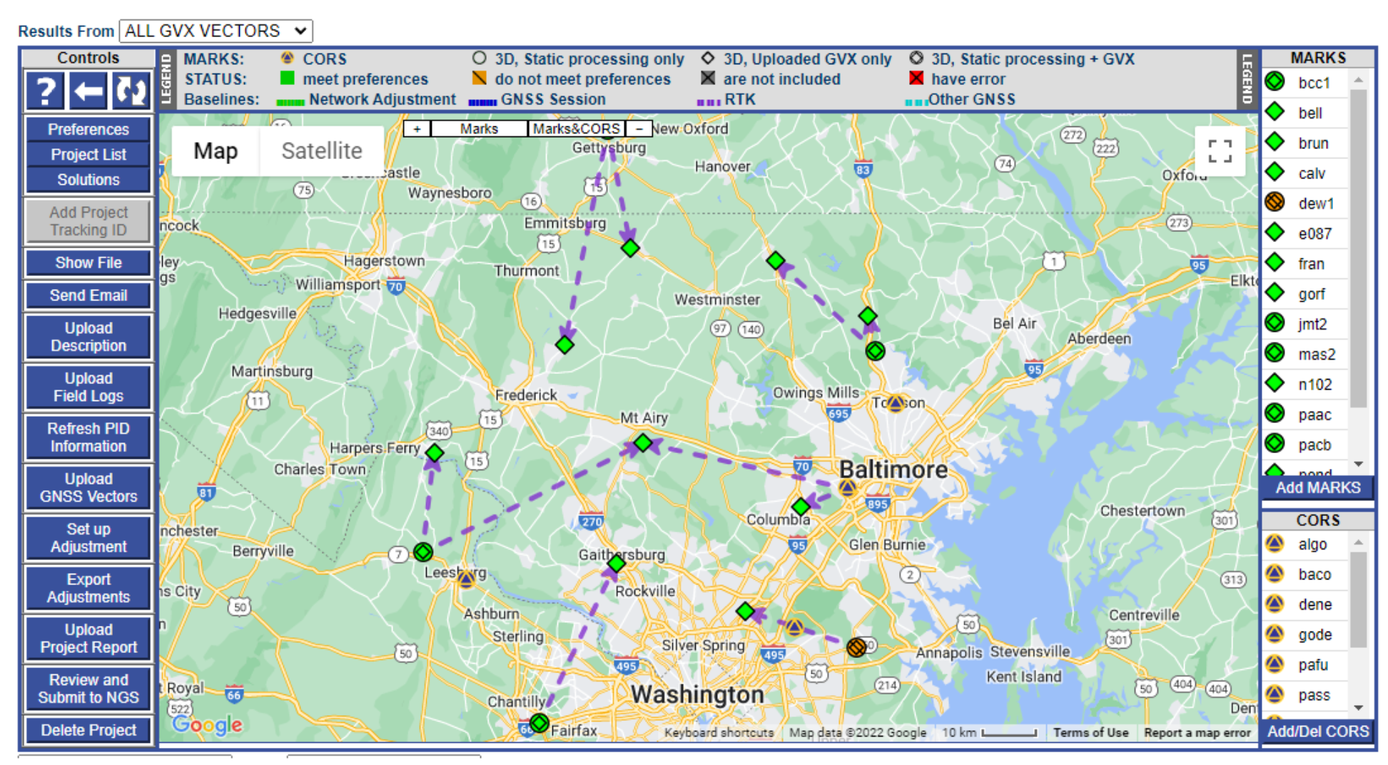
Then, prepare to upload all of the data to a project in OPUS-Projects 5 for processing, adjustment, and submission. See the OPUS-Projects User Guide for how to run the software and submit a project to NGS. The User Guide states to follow the steps in the order listed below, and it explains steps 1 - 7 and 9 - 11 in detail. For step 8 and when including GVX data in OPUS-Projects 5, refer to those portions of the User Guide's Quick Start which are highlighted in yellow. NGS is working on fully updating the User Guide to include more details; for now, use the Quick Start Guide for assistance with GVX.
- Propose a project and submit a Survey Proposal
- Create a project in OPUS-Projects 5
- Set/Verify preferences
- Upload Description Files prepared in WinDesc and upload Field Logs
- Upload all RINEX files to Beta OPUS-S. (Upload RINEX files for both the base stations and RTN Validation Station)
- Review OPUS-S solutions
- Select CORS for inclusion as control
- Upload GVX file(s)
- Process static sessions
- Adjust the network
- Upload the photos on all passive marks, upload a project report, and submit project to NGS
Including GVX Files in OPUS-Projects
After completing steps 1 - 7 above, you can upload GVX file(s) to your project by clicking on the "Upload GNSS Vectors" button from the Manager's page of your project. See the User Guide's Quick Start Guide for more details. After uploading all GVX file(s) and completing all session processing (step 9) and network adjustments (step 10 and see the Quick Start Guide for help with adjusting GVX data), then upload the photos on all passive marks (step 11).
You must upload the 3 photos for each occupied mark in the survey network. However, you are not required to upload photos for RTN base stations unless you are an RTN or station manager.
[1] Data from TBC v5.60 and later has been used successfully by NGS personnel and OPUS-Projects users.
[2] Data from MAGNET v7.3 has been used successfully by NGS personnel.
[3] J-field v3.0.11.835 will export GVX, but some statistical values are erroneous. We’d love to work with the Javad team on this issue.
[4] Data from Leica Infinity v4.0 has been used successfully by NGS personnel and OPUS-Projects users.

