LOCUS HELP
The following walkthrough is an example of how to take your ASCII vertical bluebook file (*.HGZ, produced by the National Geodetic Survey endorsed software, Translev). More information on Translev can be found under Translev "Help" tab when Translev is running.
1) After the leveling data has been processed through Translev, and all error messages cleaned up, save the ASCII *.HGZ file on your PC to the test directory in which you wish to process the file.
OR
Download the example test file locustest.zip and save it to your test directory. Unzip the file in your test directory.
2) Click the "Upload data file" menu item on left menu of main page. Click the "Choose" button and browse your PC for the recently saved and unzipped locustest.hgz file and select the file.

3) The program will take a bit of time to submit the file, run through the various procedures prior to the adjustment, and produce a list of PIDS.
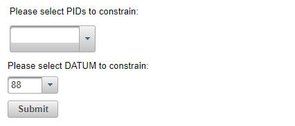
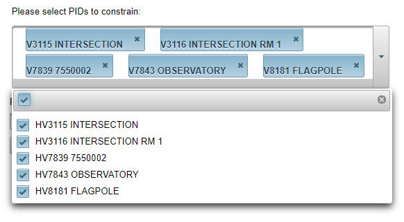
4) Please select the PIDs you wish to constrain, select the vertical datum, and press "Submit".
5) You will see the following output to the screen :

If you wish to download all of the information in the adjusted data file [filename].adj, click on the "Download the output files" button at the top of the page. You will be prompted to save or open the [filename].zip file. This will also give the user the phase1 file.
Project Transmittal:
A transmittal form should be included with the project when it is submitted to the National Geodetic Survey.� This can be generated in the Translev leveling software.
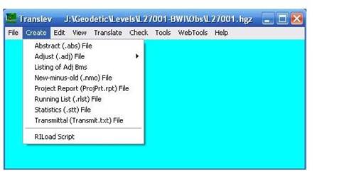
Select 'Create>Transmittal (Transmit.txt) File' from the main menu:
The transmittal dialog will be displayed:
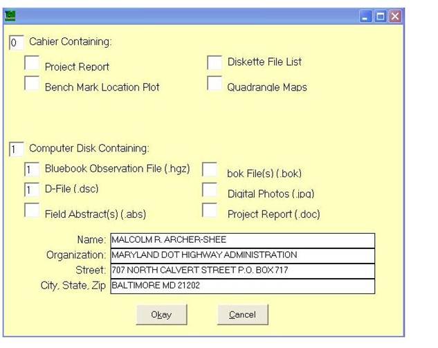
Fill in the appropriate information and click Okay to continue.
Deliverables to be included in Transmittal:
- 1 Project report (.rpt) file for entire project.
- 1 VERTOBS (.hgz) file for each part.
- 1 Description (.dsc) file for entire project (or part if separate submittal).
- 1 Abstract (.abs) file for each part.
- 1 .bok file for each part.
- 1 .raw file for each part.
On a separate CD, include digital photos for all marks that were set or recovered.
Where to Send the Project
Send two CDs (one with project files and one with photos) to:
Records Management
Observations and Analysis Division
NOAA, National Geodetic Survey, N/NGS43
1315 East-West Highway, SSMC3 Room 8400
Silver Spring, MD 20910
If you have any questions, please contact:
ngs.locus@noaa.gov for adjustment and calculation specific questions, website related comments and questions or reporting any problems using the LOCUS web page.