Abstract
This document presents instructions for the successful use of OPUS-Projects (hereafter referred to as OP). OP 4.0 was the first version of OP specifically designed to streamline the process by which a user processes and submits campaign-style GNSS surveys for inclusion in the National Geodetic Survey’s authoritative database of survey control, known as the NGS Integrated Database, or NGS IDB. As a result of a successful NGS review and acceptance, the project files are archived by NGS and the authoritative, least squares-adjusted coordinates are published and made available to anyone with an internet connection via the NGS Datasheets. Throughout the document, this entire process is simply referred to as submission to NGS and is illustrated in Fig. 1. This document should be used as a supplement to any current NGS policies/specifications which stipulate the requirements for data submission. For projects that you plan to submit to NGS, please use the Survey Project Proposal portal to obtain an official NGS-issued GNSS Project Tracking ID.
The most current version of OPUS Projects, OP 5, expands upon the functionality of OP 4 and allows for the successful use of GNSS Vector eXchange (GVX) files. By using the GVX file format, users now have the option to include real-time kinematic (RTK)/real-time network (RTN) GNSS vectors in their projects.
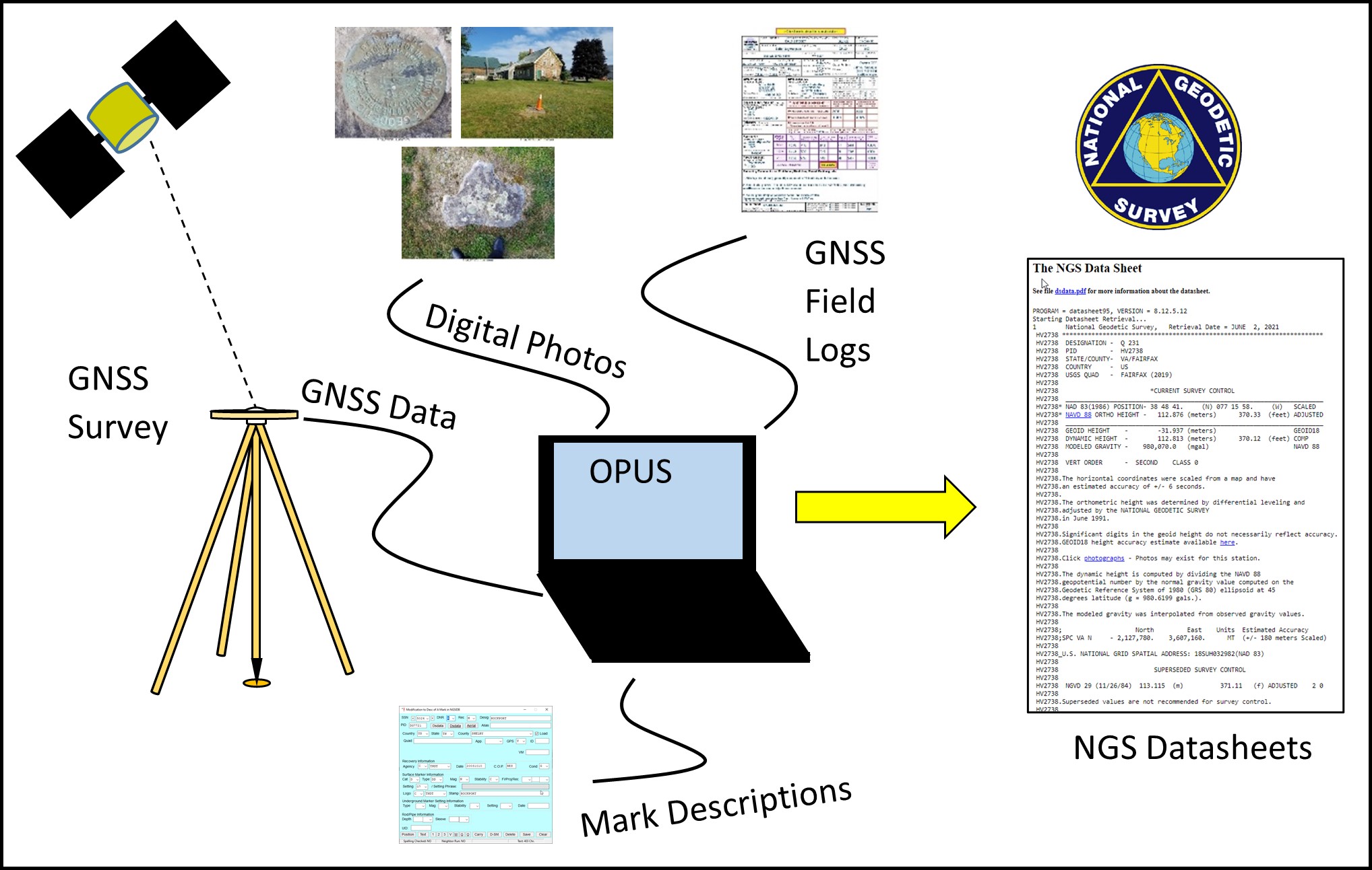
Fig. 1 OPUS Projects supports the submission of GNSS survey data to NGS for publication on Datasheets