Geoid Slope Validation Survey - GSVS 17
In the summer of 2017, the National Geodetic Survey conducted its third, and final Geoid Slope Validation Survey, GSVS17. This survey occurred in the rugged terrain of southern Colorado, USA, between the towns of Durango and Walsenburg, along highway US 160.
As in previous surveys, the intent is to quantify the accuracy of various geoid models as NGS looks ahead to creating a gravimetric geoid model for use as a national vertical datum. Long period GPS sessions, spirit leveling, absolute gravity, and deflection of the vertical observations were acquired along a 360 km line, ranging from 1900 to 3300 meters in elevation, with a station spacing of approximately 1.6 km.
These observations are used to create two estimates of geoid undulation, and this "ground truth" will be used to compare various NGS geoid models to quantify their relative accuracy.
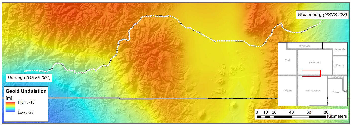
The GSVS17 route between Durango (GSVS 001) to the west and Walsenburg (GSVS 223) to the east. Longitude: 252.1° to 255.2° East, Latitude: 37.2° to 37.7° North.
Observation Types
- Long Session(24+ hours) GPS at all bench marks
- First order, class II geodetic leveling connecting the entire set of bench marks
- Gravity:
- FG-5 absolute gravity at Gravity End Points
- A-10 absolute gravity at all bench marks
- Vertical gravity gradient measurements at all bench marks
- Astro-geodetic deflections of the vertical using the CODIAC camera at all bench marks
- Airborne gravity over entire line

