• NGS Home
  • About NGS
    • What We Do
    • Mission and Strategic Plan
    • NGS Leadership
    • Programs and Products
    • Geodetic Advisors
    • NGS History
    • Policies
    • Activities in My Area
    • Grant Opportunities
    • Contracting Opportunities
    • Student Opportunities
    • FAQ
    • Contact Us
  • Data & Imagery
    • OPUS Share
    • Survey Mark Datasheets
    • NGS Web Map
    • NOAA CORS Network (NCN)
    • Antenna Calibration Data
    • Remote Sensing
    • Storm Imagery
    • Coastal Imagery
    • Shoreline Data Explorer
    • Orthomosaics
    • Lidar
    • Aeronautical Data
    • Gravity Data
  • Tools
    • Process GPS Data (OPUS)
    • Coordinate Conversion and Transformation Tool (NCAT)
    • Geodetic Tool Kit
    • Geodetic Software
    • Web Services
    • Vertical Datum Conversions (VDATUM)
    • GPS Toolbox
    • GEOID18 Computation
    • Adjust Leveling (LOCUS)
    • Horizontal Time-Dependent Positioning (HTDP)
  • Surveys
    • Survey Project Proposal Form
    • OPUS Share
    • Mark Recovery
    • User-submitted Survey Projects (Bluebooking)
    • Geoid Slope Validation Survey (GSVS)
    • Calibration Base Lines (CBLs)
    • GPS on Bench Marks
    • GRAV-D
    • Height Modernization
    • Leveling
  • Science & Education
    • Datums and Reference Frames
    • New Datums
    • Research
    • Geoid Models
    • Conferences/Training
    • Upcoming and Recent NGS Presentations
    • Educational Videos
    • Online Lessons
    • Webinar Series
    • Presentation Library
    • Publication Library
    • Commemorative Marks
    • Applications of Geodesy

Video Library


NGS, in partnership with The COMET Program, has developed short videos about topics related to geodesy and mapping. View or download our featured video or previous videos. Please visit the COMET YouTube Channel to view the entire playlist. 

image of land with houses, roads and pathways
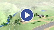
What are Geodetic Datums?
[en Español]
black and white historical photo of early surveyors
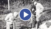
How Were Geodetic Datums Established?
image of map showing North American Datum of 1983
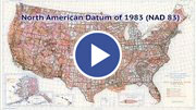
What Is the Status of Today's Geodetic Datums?

image of online NGS mapping application
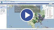
What's Next for Geodetic Datums?
image of tri-pod set up to do surveying
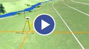
Precision and Accuracy in Geodetic Surveying
[en Español]
image of surveying near a road
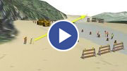
Two Right Feet? U.S. Survey Feet vs. International Survey Feet

image of the coast
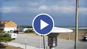
Geospatial Infrastructure for Coastal Communities: Informing Adaptation to Sea Level Rise
[en Español]
image of a surveyor using a tri-pod to survey
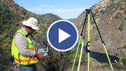
Best Practices for Minimizing Errors during GNSS Data Collection
[en Español]
image a plane flying over the shoreline
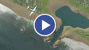
The Importance of Accurate Coastal Elevation and Shoreline Data

image of vdatum software interface
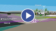
NOAA's VDatum Tool: Transforming Heights Between Vertical Datums
image of a bench mark and play buttonGeodetic Control in Land Surveying: Active vs. Passive
[en Español]
image of many NGS services with thumbnails and play buttonLocation Science Improves Everyday Life
[en Español]

    NGS Testing and Training Center

  • Home
  • Upcoming Classes
  • Past Classes
  • Video Library
  • Webinar Series
  • Online Lessons
  • Other Training Resources
  • Contact Us
  • Lodging and Directions
  • ISS Program
  • gov delivery icon

    Subscribe for training notifications

Website Owner: National Geodetic Survey  /  Last modified by NGS Training Team May 07 2024
NOS Home bullet Privacy bullet Feedback bullet Disclaimer bullet USA.gov bullet Ready.gov bullet Information Quality bullet Site Map bullet Contact Us
Return to Top