GRAV-D Data Products
GRAV-D is currently considered a preliminary data product. The available data includes processed airborne gravity data collected in an aircraft at the altitude of the aircraft. The final GRAV-D data set is being reviewed and used to create products related to the North American-Pacific Geopotential Datum of 2022 (NAPGD2022). Once NGS determines that no more changes will be made to the final GRAV-D data set, NGS will begin developing a method to deliver the final data set for public use on the public facing NGS website.
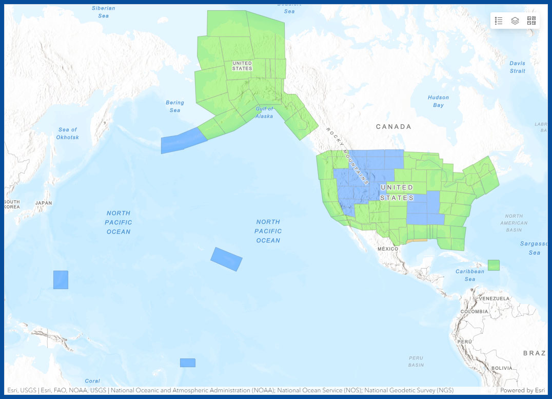
To access available GRAV-D data, open the GRAV-D Data Products Dashboard by selecting the hyperlink or the map below. Once the dashboard opens, select the block of interest in the map or list on the left. The right hand panel will populate with general information and a link that will lead to data available for download.
General Airborne Gravity User Manual
The General User Manual, which describes data distribution, field operation details, post-processing, and how to calculate commonly used gravity values, is available below. User Manuals for each block, which describes specific collection and error details for those data, are included in the zip file when the data is downloaded. Each User Manual specifies which version of the General Manual applies to that data set.
- Version 2.1: Released on September 19, 2017, this version includes updates to equipment, aircraft, accuracy calculations, and minor details for post-processing and applies to data releases starting in September 2017.
- Version 2.0: Released on March 28, 2013, this version includes significant updates to field procedures and post-processing and applies to data releases starting in February 2013.
- Version 1.1: Released on December 5, 2012, this version supersedes v 1.0 of the manual and fixes minor errors in the previous version. Most important is a corrected typo for the GRS-80 first eccentricity squared value reported on page 20 of the document.
Airborne Gravity Data - Map Key
- Green: Available data and metadata
- Blue: Data being processed
- Orange: Data collection underway
- White: Planned for data collection
GRAV-D Data Products Dashboard

Research Geoids
Starting in 2014, the National Geodetic Survey (NGS) began publishing a series of experimental geoid (xGEOID) models annually. The xGEOID models are continually improved each year and each subsequent model incorporates the new airborne gravity data that are released within the preceding year.
Research Geoids


