11.1. Session Processing Page
The Session Processing Page (as shown in Fig. 11.2)is accessed from the individual session pages, as shown in Fig. 11.1.
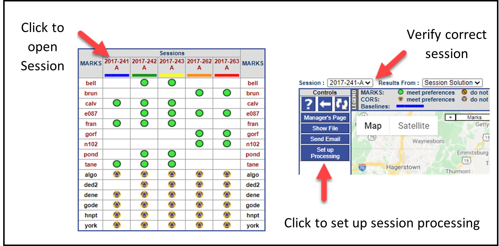
Fig. 11.1 Accessing the Session Processing Page
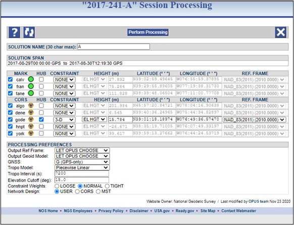
Fig. 11.2 Example Session processing page
The SOLUTION NAME is set by default to a letter corresponding to the numerical sequence of the session in a given GPS UTC day. The first session in the day will be assigned the letter “A,” the second “B,” and so on. The solution name can be changed, although that is not generally recommended (recall that the session name cannot be changed).To avoid confusion, it is recommended to append either a character/digit to the root of the session name, or a short ID like “test” or “final”. For example, if the default session name is 2020-123-A, then the digits 1, 2, 3, etc. can be added to differentiate the different re-processings. Final names would be 2020-123-A1, 2020-123-A2, 2020-123-A3, etc.)
Danger
Only the first character of a solution name is retained in the output files needed for publication in the NGS database. Therefore, names like “A-test” and “B-test” will be differentiated as “A” and “B” but names like “Test-A” and “Test-B” will be treated as the same solution “T”.
The SOLUTION SPAN provides the start and stop times for the session in UTC.
The MARK and CORS tables have the same elements:
Four-character ID, and whether the mark or CORS has met project preferences
Whether or not the mark/CORS is selected as a hub
Whether or not the mark/CORS is selected as a constraint. This means that one or more of the coordinates are held fixed within the adjustment (“fixed” within the selected constraint weights provided in the project preferences). There are three options:
3D: this is a full geometric constraint, holding latitude, longitude, and ellipsoid height fixed (within the selected type of constrained weights).
HOR-Only: only the latitude and longitude being constrained
VER-Only: only the vertical coordinate (height) is constrained.
Where the height value is coming from:
EL HGT can come from the first session processed, or a published datasheet value
GEOID refers to the orthometric height, regardless of the source of that orthometric height (GNSS-derived or leveling-derived).
Latitude (degrees, minutes, seconds)
Longitude (degrees, minutes, seconds)
Processing Preferences: these correspond to the values selected in the Project Preferences (Section 4.4). Network Design is explained in the next section.