8.1. Adding or Deleting CORSs
CORSs (including IGS stations) can be added or removed from either the Manager’s Page or the Session Page.
Caution
Adding or Deleting a CORS from a Session Page will only add/delete the CORS for that session. Adding or deleting a CORS from the Manager’s Page will add/delete the CORS to ALL sessions

Fig. 8.1 Add/Delete CORS button on the project map
Clicking on the Add/Del CORS button, shown in Fig. 8.1, opens a new window in which CORSs can be added or removed from the project (see Fig. 8.2 for an example).
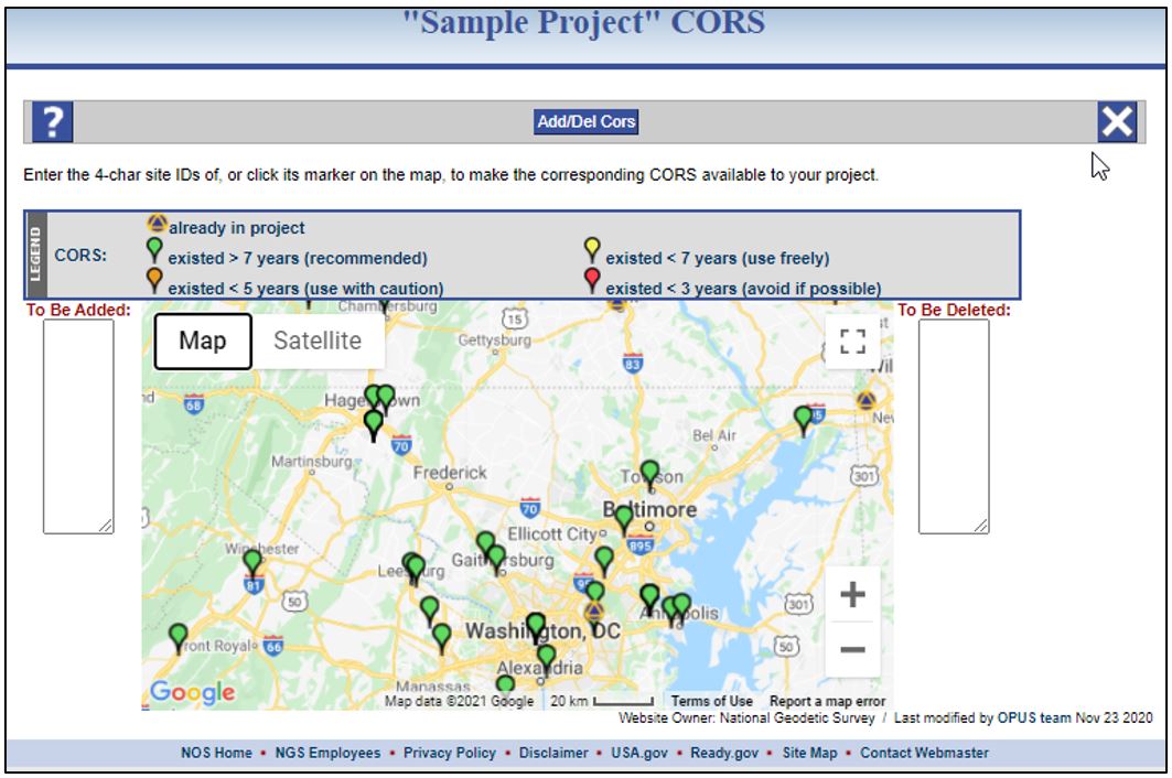
Fig. 8.2 Add/Delete CORS pop-up window
The CORSs are displayed according to the legend, which distinguishes the stations based on their cumulative time series. The map is sensitive to the scale: at a small scale, only those CORSs already selected by OPUS to be in the project, and those CORSs with more than 7 years of data are visible. These are the stations that are typically viewed as “candidate” CORSs for your project. As you zoom in (using the +/- toggles on the map, or the wheel of your mouse), CORSs with shorter time series will appear. These are to be used with caution, according to the legend.
Caution
The longer a CORS has been in operation, the greater the likelihood of the relative stability of its coordinates compared to younger stations, except in areas of known land movement, where age may track discrete coordinate shifts
Clicking on a CORS will provide additional information, as shown in Fig. 8.3, including the four-character ID, cumulative time series, and links to the site log and data availability. The link to the data availability is particularly handy for determining if the CORS has data available for processing during the entire survey project.
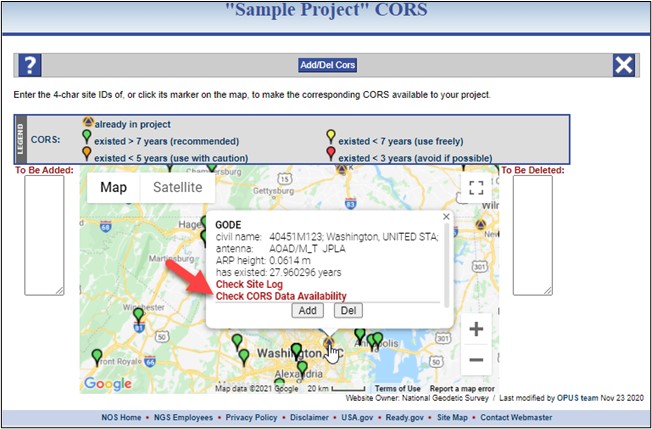
Fig. 8.3 CORS information bubble on the Add/Delete CORS window
The user can click the “add” or “delete” button in the window for the CORS you have selected. Alternatively, the user can type the four-character ID into the list for CORSs to be added or deleted. The graphic map interface can be used to help select the CORSs that will eventually be used for controlling the GNSS project.