NOAA Foundation CORS Network
The NOAA CORS Network (NCN) is a multi-purpose cooperative network of GNSS
stations from over 200 government, academic, and private organizations. Its primary objective is to
enable GNSS users by providing precise positioning relative to the U.S. National Spatial Reference System
(NSRS) (PDF, 123 KB). Density considerations and the nature of partner-owned stations limited the
number of NCN stations that contributed to the determination of the International
Terrestrial Reference Frame (ITRF) versions 2014 and earlier.
To maintain long-term consistency between the NSRS and the ITRF, a specific set
of stations must be operated at the highest standards and federally-owned to ensure longevity. NGS has
identified a set of 36 stations across the U.S. and its territories that meets this criteria and provide
consistent national access to the NSRS. This subnetwork of the NCN will be known as the NOAA Foundation
CORS Network, or NFCN.
Operational Goals of the NFCN
- Formal agreements signed with partners for project support.
- All NGS-owned Foundation CORSs are submitted for inclusion in the International GNSS Service (IGS) network.
- Targeted Operational Time:
- Network availability > 90 % at all times.
- Individual Station down time < 14 days
- Stations provide definitional support for the ITRF and plate rotation models.
- Site surveys conducted to International Earth Rotation and Reference Systems Service (IERS) standards (PDF, 9 MB) are repeated on a 5-year cycle at each Foundation CORS.
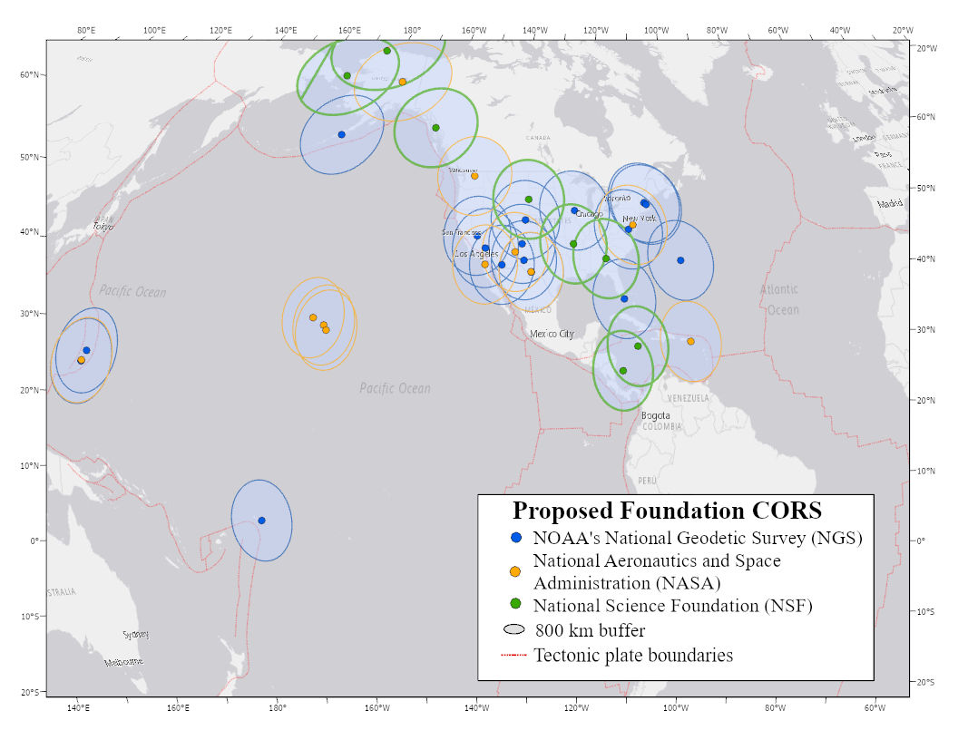
- Foundation CORSs will be no more than 800 km apart.
Map of Proposed Foundation CORS
See the list of proposed CORS
Potential Contributing Federal Partners
- National Science Foundation (NSF)
- National Aeronautics and Space Administration (NASA)

