GEOID18 Downloads
The GEOID18 grid files in the little endian and ASCII grid formats that were posted on this page prior to November 26, 2019, contained errors in a small percentage of the grid cells (1 in 500). NGS has since corrected the errors and replaced these files. We encourage users that have previously downloaded any of the little endian or ASCII grid formats below to immediately replace them with the updated grids.
More InformationNGS has created a list of check points for each of the GEOID18 subgrids, so users can tell if the grids they are using are affected by this error. In addition, several files (kml, shapefile, xlsx ~11MB) are available to plot all of the bad grid cells and illustrate the areas affected by the errors (~1 arcmin buffers).
GPS on Bench Marks (GPSonBM) list for GEOID18 Download


Program Downloads
The National Geodetic Survey has provided two computer programs for users working with GEOID18. Compiled executables for both Windows (intg.exe and xntg.exe) and Linux (intg_v34.exe and xntg) platforms. The source code is located in a compressed zip file. INTG interpolates geoid heights from data files using user-provided coordinates. XNTG extracts sub-grids from the binary data files, converts back and forth between binary and ASCII data formats, and provides statistics regarding a data file.
To determine geoid heights with the GEOID18 model, download an INTG executable file, as well as at least one data file. You need to select only those data files that cover your region of interest; the program will recognize the available corresponding files . Select one or more of the data files using either the graphical or data interfaces.
Download the data files for your computer's operating system. The binary formats of the Linux format data files follow the IEEE Std. 754 binary format (big-endian), as they are developed in a Linux environment. INTG and XNTG programs are designed to determine the user's platform and will automatically byte swap the data. Data files for use on a Windows platform (little endian) are reformatted accordingly.
Programs
- PC Win32 executable intg.exe (Version 3.4, 2019 Sep 9)
- Linux executable intg_v34.exe (Version 3.4, 2019 Sep 9)
- Source code intg_v34.zip (Version 3.4, 2019 Sep 9)
- PC Win32 executable XNTG.EXE (Version 1.2, 2009 Jun 15)
- Unix (Sun) binary executable XNTG (Version 1.2, 2009 Jun 15)
- Source code xntg_v12.zip (FORTRAN) (Version 1.2, 2009 Jun 15)
INTG
XNTG
GEOID18 Grids for Conterminous United States (CONUS)
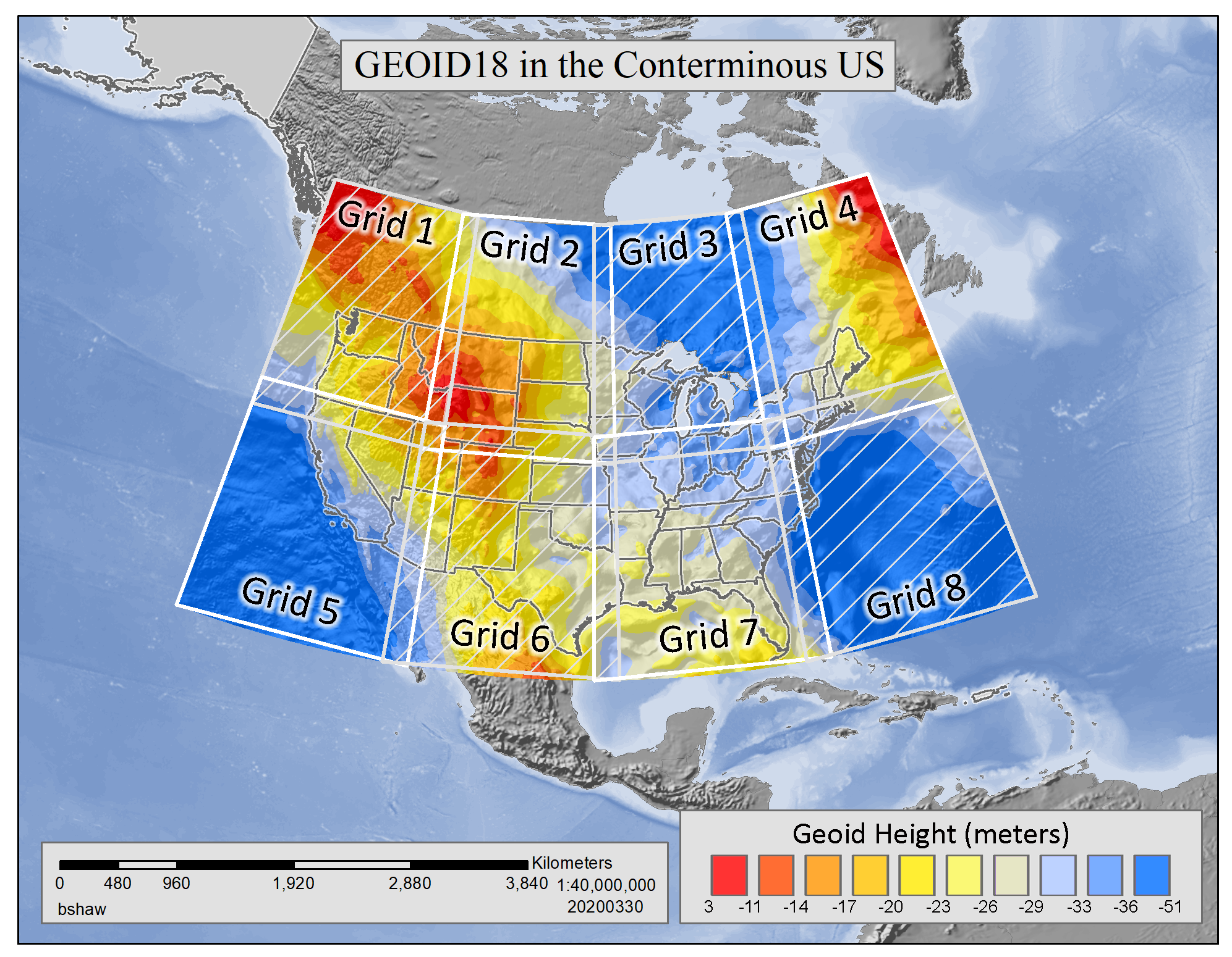
Grid #0 is 4201 columns by 2041 rows
Grids #1-#8 are 1141 columns by 1081 rows
*le - little-endian (Generally for PC use)
**be - big-endian (Generally for UNIX use)
Grid#
Coordinates
le* Binary
be** Binary
Compressed ASCII
GEOID18 Data for Puerto Rico and U.S. Virgin Islands
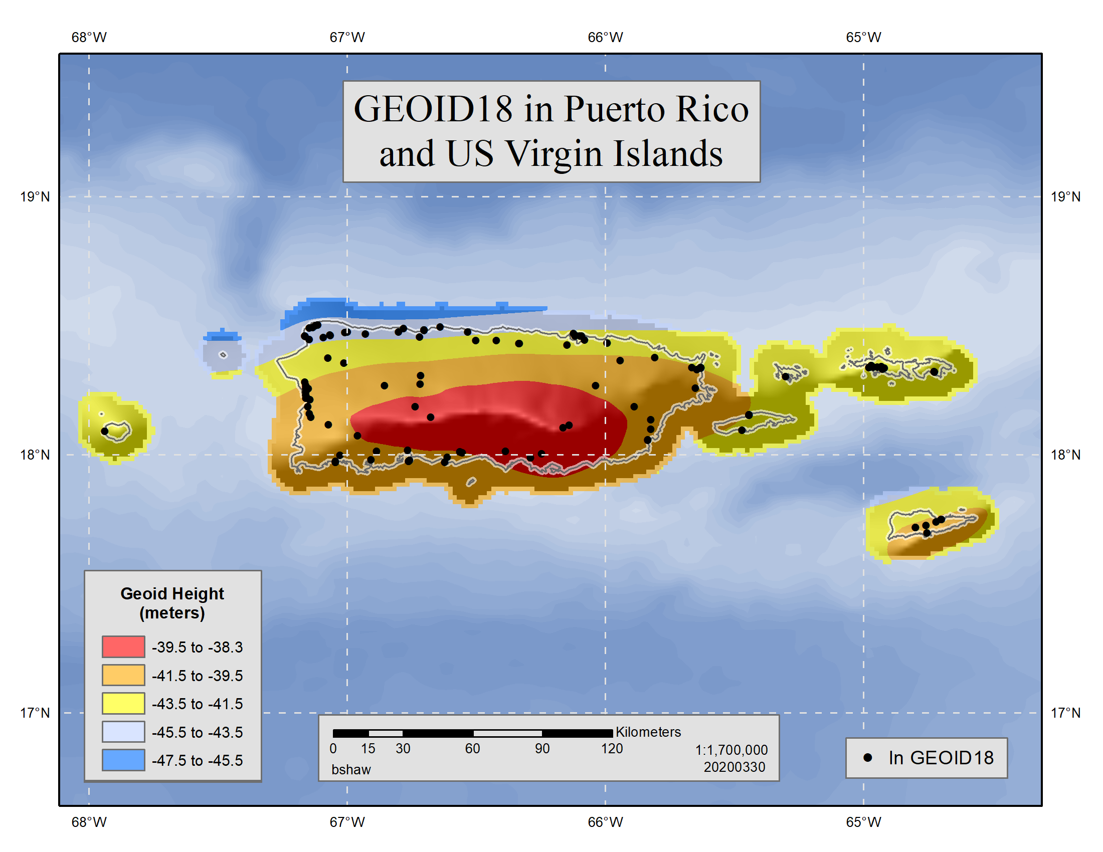
Grid #0 is 301 columns by 361 rows
*le - little-endian (Generally for PC use)
**be - big-endian (Generally for UNIX use)
Grid#
Coordinates
le* Binary
be** Binary
Compressed ASCII
Disclaimer
For more information contact NGS Information
Services: by email,
or call (301) 713-3242, Monday-Friday, 7:00 AM - 4:30 PM eastern time.
For questions about this page or downloading problems, contact the
Webmaster.

