What is geodesy?
Geodesy is the science of accurately measuring and understanding the Earth's geometric shape, orientation in space, and gravity field.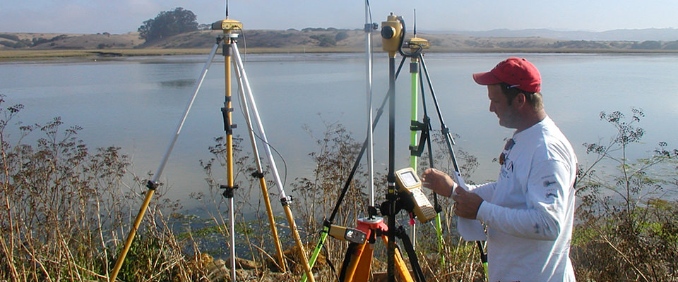
Using GPS, geodesists can monitor the movement of a site (orientation in space and gravity field) 24/7.
More Information
Many organizations use geodesy to map the U.S. shoreline, determine land boundaries, and improve transportation and navigation safety. To measure points on the Earth’s surface, geodesists assign coordinates (similar to a unique address) to points all over the Earth. In the past, geodesists determined the coordinates of points by using Earth-based surveying tools to measure the distances between points. Today, geodesists use space-based tools like the Global Positioning System (GPS) to measure points on the Earth’s surface.
Geodesists must accurately define the coordinates of points on the surface of the Earth in a consistent manner. A set of accurately measured points is the basis for the National Spatial Reference System, which allows different kinds of maps to be consistent with one another.
Because the ellipsoid is based on a very simple mathematical model, it can be completely smooth and does not include any mountains or valleys. When additional detail of the Earth is needed, geodesists use the geoid. A geoid has a shape very similar to global mean sea level, but this exists over the whole globe, not just over the oceans.
A set of accurately measured points is the basis for the National Spatial Reference System (NSRS), which allows different kinds of maps to be consistent with one another. Many organizations use geodesy to map: the U.S. shoreline, determine land boundaries and improve transporation and navigation safety.

