Monthly Height Modernization Coordination Meeting
2014 Presentation and Meeting Notes Archive
At monthly meetings, speakers are invited to give presentations or facilitate discussions on various topics related to Height Modernization. The presentations add value to the meeting, educate constituents about NGS activities, and gather feedback from users of NGS projects.
View the 2014 schedule, presentations, and notes below.
Jan | Feb | Mar | Apr | May | Jun | Jul | Aug | Sep | Oct | Nov
View other monthly materials: 2015 | 2013 | 2012 | 2011 | 2010 and earlier
November 13, 2014
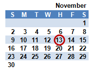
"San Francisco - One in a Million"
Michael McGee, McGee Surveying Consulting
The presentation will discuss the mechanics of establishing a high precision GNSS geometric (3D) network and a vertical control network for the purpose of supporting planning, development, the GIS and to serve as a deformation network. One of the main purposes of this project is to develop specifications and procedures to obtain sub-centimeter orthometric heights in the City utilizing GNSS technology to replace differential leveling.
meeting notes
presentation
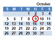
Updating NGS 58 & 59: Guidelines for Establishing Heights
Dan Martin, National Geodetic Survey
presentation
Michael Dennis, Oregon State University/National Geodetic Survey
presentation
Charlie Geoghegan, National Geodetic Survey
presentation
Dr. Gerald Mader, National Geodetic Survey
Dr. Gillins, Oregon State University
presentation
In order to take advantage of GPS surveying to economically density
vertical control, NGS published guidelines for using static,
post-processing GPS technology to establish accurate ellipsoid
heights (NGS 58 in 1997) and accurate orthometric heights
(NGS 59 in 2008)
on passive control. Since those guidelines
were published, many advances in science and technology have
prompted NGS to re-examine how GNSS may best be suited to
optimally determine ellipsoid
heights and orthometric heights,
whether or not it is applied to extending passive vertical control.
Test data has been collected using a variety of techniques and
preliminary processing completed. Analysis of the results will
be used to formulate recommendations for updating the
guidelines.
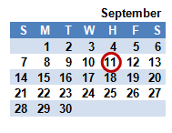
Harris-Galveston Subsidence District
Cliff Middleton, National Geodetic Survey
The Harris-Galveston Subsidence District was created to provide for the regulation of groundwater withdrawal throughout Harris and Galveston counties for the purpose of preventing land subsidence, which leads to increased flooding. This presentation will highlight Height Modernization efforts focused on measuring and monitoring subsidence in the Harris-Galveston area.
presentation
meeting notes
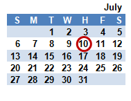
Silver Jackets: coordinating efforts to reduce flood risk
Jennifer Dunn, U.S. Army Corps of Engineers
The Silver Jackets is an innovative program that provides an opportunity to consistently bring together multiple state, federal, and sometimes tribal and local agencies to learn from one another and apply their knowledge to reduce flood risk. Federal agencies, including the U.S. Army Corps of Engineers (USACE) and the Federal Emergency Management Agency (FEMA), are partnering to
form a unified forum to address the state's flood risk management
priorities. Silver Jacket programs are developed at the state level.
presentation
meeting notes
Canadian Geodetic Vertical Datums
Marc Véronneau, Canadian Geodetic Survey, Natural Resources Canada
Natural Resources Canada (NRCan) has released the Canadian Geodetic Vertical Datum of 2013 (CGVD2013), which is now the new reference standard for heights across Canada. This new height reference system is replacing the Canadian Geodetic Vertical Datum of 1928 (CGVD28), which was adopted officially by an Order in Council in 1935. This presentation will review the evolution of the
CGVD28 network,
highlight the technical advances that made possible
the realization of CGVD2013 and summarize the differences users
should expect when migrating to the new datum.
presentation
meeting notes
Hunting for Sea Levels in Alaska
Nicole Kinsman, Alaska Division of Geological & Geophysical Surveys
This presentation will present an overview of some of the day-to-day challenges associated with working on elevation-sensitive projects beyond the limits of tools such as VERTCON and VDatum, with an emphasis on the coastal zone. This will include describing some of the unique problems associated with vertical measurements of both the land and sea in rural Alaska from the perspective of a non-surveyor.
It will also highlight stop-gap approaches for dealing with some of
these issues, uses of the NGS shared OPUS database, and insights
into future needs.
presentation | April 2014 Status
meeting notes
2014 GPS on Bench Marks Campaign
various speakers, National Geodetic Survey
NGS encourages anyone with survey-grade Global Positioning System (GPS) receivers to join the 2014 GPS on Bench Marks Campaign, a National Surveyors Week (March 16-22) event to raise awareness about professional surveying while improving the National Spatial Reference System (NSRS). NGS speakers will discuss why and how to participate.
meeting notes
International Great Lakes Datum (IGLD) and Dynamic Heights
Dave Conner and Michael Dennis, National Geodetic Survey
An overview of IGLD will include its development history, plans for the future, and the role of the Coordinating Committee on Great Lakes Basic Hydraulic and Hydrologic Data. Then, an introduction to dynamic heights will include explaining their significance, what they are, when they are useful, how they are related to IGLD, and why they are challenging to determine with GNSS.
presentation 1 | presentation 2
meeting notes

