Aerial Photography
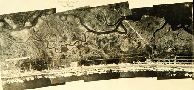
This photo mosaic was prepared using images collected during the first C&GS aerial photographic mission, which took place along the New Jersey coast, near Atlantic City, in 1919.
By the late 1800s, photography was recognized as a useful tool for mapping. C&GS first used a surveying camera with a plane table for mapping the international boundary between Alaska and Canada in 1894. This use of ground photos for mapping continued through the early 20th century.
By the turn of the century, aerial cameras with multiple lenses had a much wider field of view, so they were used with airships (dirigible balloons) and eventually airplanes. In 1919, C&GS began investigating aerial photography to compile coastal topography.
Since the late 1930s, aerial photographs have become the primary source for shoreline information on nautical charts. They also provide information to define the boundaries, make coastal management decisions, involved in mapping other disaster sites to support recovery effort and other applications.

