Coastal Mapping and Related Disciplines
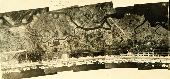
This photo mosaic was prepared using images collected during the first C&GS aerial photographic mission, which took place along the New Jersey coast, near Atlantic City, in 1919.
Created in 1807 by President Thomas Jefferson to provide nautical charts to the American maritime community for safe passage into American ports and along our extensive coastline, this earliest agency laid the groundwork for a legacy of products to enhance the safe and efficient navigation of our nation’s waterways.
From the original mandate to survey the U.S. coastline, our charting and coastal mapping pieces have grown. Today’s national shoreline provides the critical baseline data for demarcating America's marine territorial limits, managing coastal resources and many other uses.

