Coastal Mapping
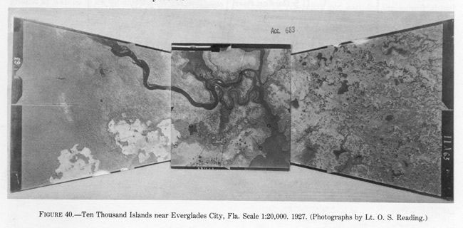
Photos taken with multi-lens cameras offer a larger view of the ground than those taken with a single-lens camera. This composite image was created using three separate photos all taken at the same time using a three-lens camera.
Nautical charts were built from two types of surveys. Hydrographic surveys mapped the depths of coastal waters and off-shore hazards. Topographic surveys mapped the shoreline’s natural and cultural features, its elevations above the sea, and formed the basis for a coastal mapping program.
The coastal mapping program began using plane table surveying or mapping. Beginning in 1919, the C&GS began using aerial photographs to produce shoreline maps. Today, NGS uses additional remote sensing techniques, primarily with multiband digital imagery and lidar.

