Distance Measuring Tools
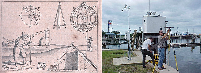
The evolution from the optical methods depicted in the 17th century drawing on the left to global positioning system technology shown on the right has allowed hundreds of miles of evacuation routes and levees to be accurately measured at a rate unheard of in the 1600s. Left-hand image courtesy of the Treasures of the NOAA Library Collection, archival photographer Sean Linehan. Right-hand image courtesy of Davey Crockett, NGS.
Classical (pre-GPS) geodetic surveyors measured angles and distances with highly accurate equipment and techniques.
The evolution of tools used to make extremely accurate distance measurements has changed significantly from steel bars used in the 1800s to modern global positioning system equipment used today.
The evolution of technology included the surveyor's "chains"; metal bars and rods; metal tapes; and eventually Electronic Distance Measuring Instruments (EDMIs).

