Gravity Surveys
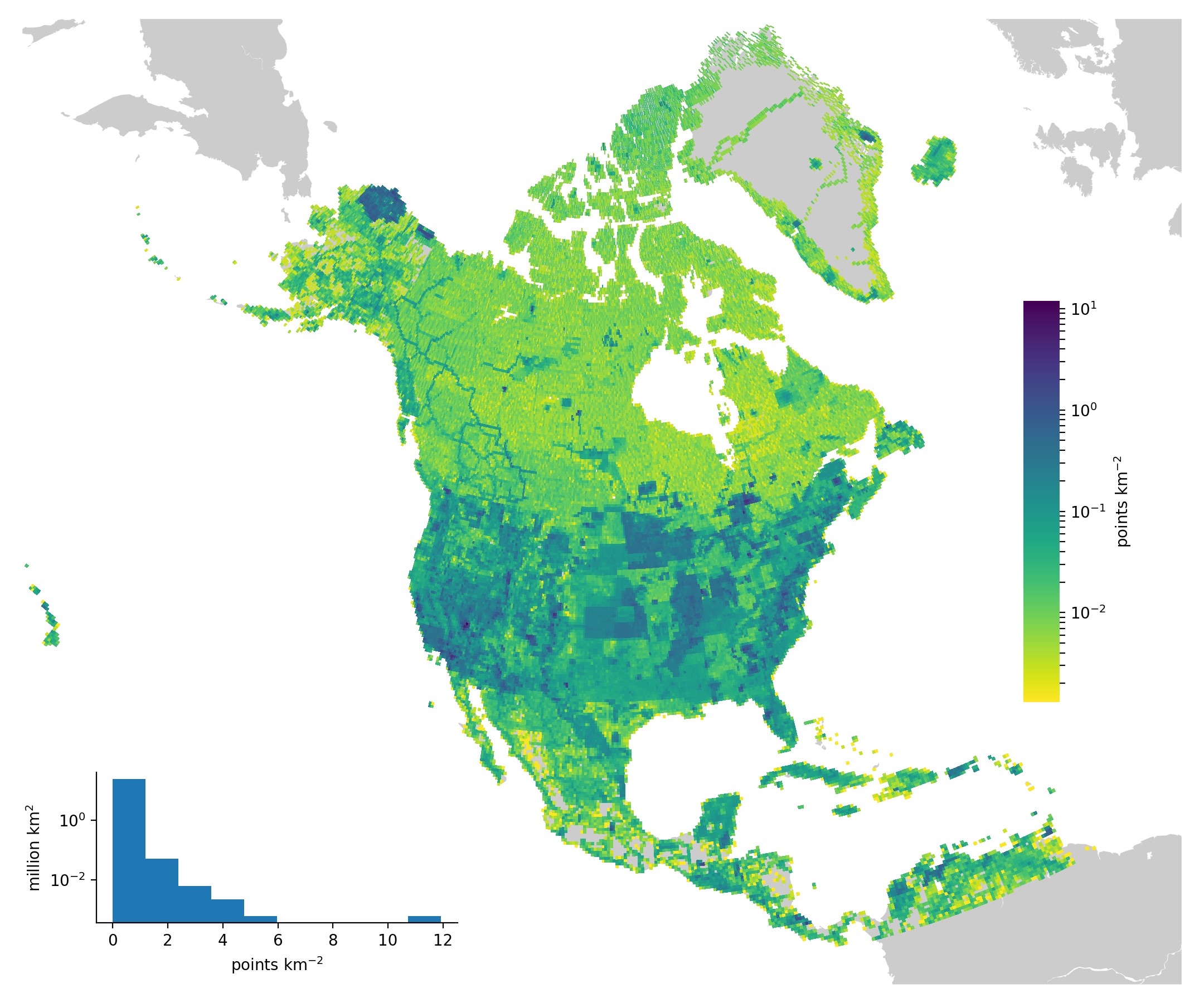
Map showing the NGS gravity terrestrial database.
Since the 1870s, the U.S. Coast Survey and its successors have been at the forefront of measuring the acceleration of gravity in the U.S. Scientists have established “stations” with known gravity values; then, these known values become baselines for other relative gravity measurements.
In the 1890’s, close to 340 domestic stations (including territories) were established using the Mendenhall pendulum, including work in Alaska in 1891 and a trans-continental traverse in 1895. Over time, gravity values were collected in statewide surveys, surveys along level lines, as part of gravimetric deflection studies, and more.
Between 1976 and 1979, NGS undertook a contiguous U.S. survey to re-observe most International Gravity Standardization Net 1971 (IGSN-71) sites and establish the NGS Gravity Network. NGS has used gravity data to generate sequentially improved models of the geoid, which, when used with other surveying data,

