Establishing Survey Networks
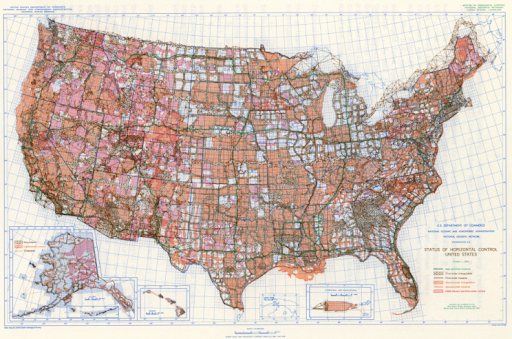
This was the status of horizontal control in the United States, October, 1, 1983.
A survey network is a group of survey points all inter-connected such that they are all in a common coordinate system. The nation's first surveyors needed to establish known positions on the land before they could position survey vessels at sea to measure the water's depth. A consistent and accurate survey network would ensure that the many surveys that would be done along the U.S. coastline would fit together properly. It also ensured that land surveys would fit together.
By means of triangulation (and traverse) method, all the surveyed points are interconnected forming a unified survey network. A survey network was the key to having all topographic (land) and hydrographic (water) surveys based on a common coordinate system, thus ensuring that surveys fit together correctly when they met. Today, we call this survey network the National Spatial Reference System.

