Plane Table Surveying
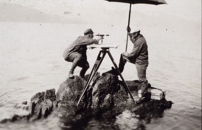
Here, a plane table is used to map an area in Alaska.
The first hundred years of shoreline mapping in the Coast Survey relied on a method called plane table surveying. The plane table was the best instrument for quick yet accurate topographic mapping.
The first plane table crew of the Coast Survey drew its first shoreline map in New York in the fall of 1834. The next year, a second mapping party was formed. The number of parties grew as would their progress in mapping the coast.
By 1855, 540 topographic survey maps, scattered throughout the Atlantic, Gulf, and Pacific coasts, had been completed and registered. The plane table continued as the primary method of mapping the coastline for the next 80 years.

