SPIRIT LEVELING
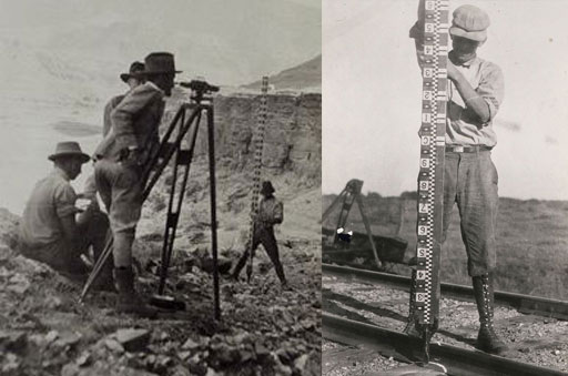
Left image: This party is using a Fischer level to leapfrog its way into Glen Canyon in 1921.Right image: Traditional leveling involved using a level to read numbers marked on a rod, such as the one shown here
“Spirit leveling” was used to collect accurate elevation data. It is performed with an instrument that is a combination of a telescope and a spirit level vial. Called a level, the instrument is used to read values from a set of specially constructed and marked rods. Building off of known elevations and carrying elevations forward from point to point with a level and rods, surveyors construct a “level line.”
Level lines are marked by periodically placing benchmarks in the ground along the line. NGS has been in the business of leveling since the 1800s, and has placed hundreds of thousands of benchmarks across the U.S. These benchmarks are a fundamental component of the National Spatial Reference System.

