Triangluation, Traverse and Horizontal Networks
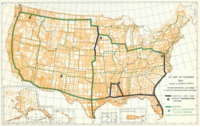
The status of completed (solid black lines) and planned (solid and dotted green lines) surveys for the TCT as of January 1, 1967. Although the traverse was an independent survey, it was frequently tied to the existing U.S. survey network shown by the wide orange-colored lines.
Triangulation is a type of surveying that uses the principles of trigonometry to determine positions on the surface of the Earth (i.e., latitude and longitude). This method was used to extend the survey network from its start in New York, north to Maine, southwest to New Orleans and eventually across the entire U.S.
A traverse is another survey method, and it uses series of survey points that are often laid out in approximately a straight line. The angles and distances measured along the traverse can then be used to compute the positions (latitude and longitude) of each survey point along the line.
In 1871, a major effort, known as the Transcontinental Arc of Triangulation, was undertaken to conduct a very precise survey across the country. Advances in technology allowed C&GS to complete a high-precision Transcontinental Traverse in the 1976.

