
NGS Weekly

NGS Reevaluates the Heights of Colorado Mountains

April 26, 2024

NGS researchers estimated new elevations for many Colorado peaks above 14,000 feet in a new study published in the Journal of Geodesy. Colorado has more than 50 “14ers,” or peaks above 14,000 feet, and they will get shorter when a new national vertical datum is implemented in 2025. The current mountain elevations were found to be too high by roughly 1 meter. Researchers developed a novel technique to redetermine the heights by drawing from the historical triangulation data measured in the 1950s, new airborne lidar data, and several current geoid models. Uncertainty estimates of the summit elevations are available for the first time, and the paper highlights differences in the geoid models available globally. The study emphasizes the importance of the upcoming modernization of the National Spatial Reference System, which is the foundation for all surveying and mapping in the U.S. Its modernization will significantly improve height accuracy.

For more information, contact: Kevin Ahlgren


NGS Performs Space Geodesy Survey at NASA Observatory

April 18, 2024

NGS staff provided their surveying expertise to measure local tie vectors of four high-precision space geodetic technique, or SGT, instruments at NASA’s Goddard Geophysical and Astronomical Observatory in Greenbelt, Maryland. Tie vectors connect coordinate frames of different space geodetic techniques, and the Goddard Observatory is one of four sites in the world to host all four SGTs — Global Navigation Satellite System, Very Long Baseline Interferometry, Satellite Laser Ranging, and Doppler Orbitography and Radiopositioning Integrated by Satellite — at a single location. The collocation of these SGTs is an essential part of the International Earth Rotation and Reference Systems Service for current and future International Terrestrial Reference Frame, or ITRF, computations. The National Spatial Reference System and the NOAA Continuously Operating Reference Stations Network are aligned to the ITRF.

For more information, contact: Kevin Jordan


NGS Collects Imagery after Bridge Collapse

April 12, 2024

NGS conducted flights for imagery collection of the Francis Scott Key Bridge and surrounding channel to support NOAA nautical chart development, hazardous material removal, marine debris collection, and other coastal management needs. The flights produced expedited, updated shoreline information about the region around the Francis Scott Key Bridge. The collected data enabled the charting of the remaining bridge piers for a potential auxiliary channel and the updating of NOAA Electronic Navigational Charts. This data was shared with the appropriate local, state, and federal agencies responding to the event and conducting recovery efforts. The high-resolution imagery will be the event’s baseline dataset and will help inform anticipated engineering and debris removal.

For more information, contact: Mike Aslaksen


U.S. and Canada Agree on Common Reference Frame Grid Format

April 5, 2024

NGS and the Canadian Geodetic Survey, or CGS, finalized a landmark agreement to use a common grid format, the Gridded Geodetic data eXchange Format. This common data format is expected to allow our two countries to more easily exchange and share data on positioning and navigation as the U.S. modernizes our nation’s coordinate system, the National Spatial Reference System, in 2025. The common data format will be the official format for all products and services released with the Modernized National Spatial Reference System. In addition, NGS has started to back-translate older grids into this format. NGS and CGS took this first collaborative step on common standards for the joint adoption of the North American Terrestrial Reference Frame of 2022 and the North American-Pacific Geopotential Datum of 2022 in 2025.

For more information, contact: Dru Smith


NOAA and U.S. Geological Survey Launch Datums Working Group

April 2, 2024

NGS, CO-OPS, and OCS staff joined National Weather Service and U.S. Geological Survey personnel, or USGS, to launch a new Datums Working Group as part of the NOAA-USGS Quarterly Meeting on Hydrology. A geodetic datum is a reference frame for precisely representing the position of locations on Earth. USGS, which maintains a national network of streamgages and water level stations, is preparing for the modernized National Spatial Reference System, the nation’s coordinate system, in 2025. USGS is also adapting its workflows for the releases of the North American-Pacific Geopotential Datum of 2022 and the National Tidal Datum Epoch in the next few years. The current epoch, established by CO-OPS, spans from 1981‒2001. The new epoch will span 2002‒2022. The working group is developing a charter and identifying initial topics for exploration.

For more information, contact: Philippe Hensel


NGS Presents at Hydrographic Services Review Panel

March 22, 2024

NGS delivered updates on their progress toward modernizing the National Spatial Reference System, or NSRS; on the Coastal Mapping Program; and on Emergency Response Imagery operations during the Spring 2024 Hydrographic Services Review Panel, or HSRP, virtual public meeting. NGS also led a session on the NGS Geospatial Modeling Grants and featured the principal investigators from the two West Coast grantees: Scripps Institute of Oceanography and Oregon State University. The HSRP approved an issue paper titled “Digital Twin: A Cornerstone for NOAA’s Coastal and Ocean Mapping Programs and Coastal Resilience” that includes a recommended series of actions for NOAA to support Findable, Accessible, Interoperable, Reusable data principles and the Modernized NSRS as an underlying foundation to support digital twin development.

For more information, contact: Galen Scott


NGS Collects Lidar Data in the Caribbean

March 15, 2024

NGS crews are using a newly upgraded lidar sensor, with increased collection depth and better fidelity, to expeditiously fill in some data gaps from previous years’ collections while the weather is suitable in the Caribbean. These data collections continue to help us update the national shoreline and near-shore bathymetry data sets to bolster the nation's safety-of-navigation efforts. Using airborne lidar to gather topographic data fills the gap from where deep-water mapping efforts are unable to operate due to hazards. This continues our support of critical coastal activities ranging from marine planning to emergency response. The national shoreline is a key feature of nautical charts and must be updated periodically to reflect changes due to storms, flooding, sea level change, erosion, and subsidence.

For more information, contact: Mike Aslaksen


Prototype GEOID2022 under Development

March 8, 2024

NGS released a prototype geoid model of the U.S. and its territories, known as the GEOID2022, to select key academic and international partners for evaluation. The model is a foundational component of the modernized National Spatial Reference System — or NSRS, the nation's coordinate system — which is expected to be released in 2025. The prototype will increase the accuracy and coverage of precise surface elevation measurements over land and water and will be used to initialize marine circulation models. The prototype will also communicate water-level forecasts and warnings for tsunamis, surges, flooding, and inundation. GEOID2022 develops a vertical reference of the earth’s surface and includes gravity data from the recently completed 16-year Gravity for the Redefinition of the American Vertical Datum, or GRAV-D project, which collected height data using aerial surveys. More geoid products and services will be released later in 2024.

For more information, contact: Shachak Peeri


NGS Visits Alaska and Presents at Surveyors Conference

March 1, 2024

The NGS Regional Advisor Branch chief, state plane coordinate system manager, and the Alaska regional geodetic advisor presented NGS updates at the Alaska Society of Professional Land Surveyors Conference. NGS plays a leading role in the state, updating critical geospatial infrastructure. Alaska is tectonically active, with the longest coastline in the nation and challenging weather and ocean conditions. The Regional Advisor Branch chief and the Alaska regional geodetic advisor visited the Alaska offices of OCM, OCS, NWS, and private sector partners. The NGS representatives also met with partners at EarthScope Consortium, the University of Alaska Anchorage, and the U.S. Geological Survey. .

For more information, contact: Christine Gallagher


NGS Kicks Off Relative Gravity 2024 Project

February 23, 20214

NGS staff began relative gravity surveys in North Carolina and Houston, Texas. These surveys have officially launched the NGS project, Relative Gravity 2024, or RelGrav2024, which was paid for with Bipartisan Infrastructure Law funding related to geopotential modeling. This data will not be collected in time for inclusion in the first version of the North American-Pacific Geopotential Datum of 2022, but will help with future versions. NGS has been able to estimate gravity field uncertainties throughout the continental U.S. as they’ve been analyzing the gravity field information for the new vertical datum. These uncertainties, plus some other categories, will drive which areas are prioritized for relative gravity data collection. Other categories include areas with significant change in the gravity field or geoid slope, areas with greater population density, and areas with important infrastructure. The team plans to continue collecting data associated with RelGrav2024 in different locations throughout fiscal year 2024.

For more information, contact: Jeffery Johnson


NGS Is a Founding Member of World Lidar Day

February 16, 2024

NGS, along with many public and private partners, is a founding member of World Lidar Day, which will celebrate lidar and its expanding applications each year on February 12. The holiday will coincide with Geo Week, one of the world’s largest geospatial conferences. The NGS Remote Sensing Division and the Coastal Mapping Program have pushed the limits of lidar technology for the past two decades. Using lidar data collected from NOAA aircraft and the VDatum software tool to transform between tidal and geodetic datums, NGS developed the procedures for extracting the national shoreline for official U.S. nautical charts. NGS has driven advances in topobathy lidar to map the nearshore zone, dramatically increasing the efficiency of accurate data collection for nautical charts in shallow water. This lidar use also decreased the risks faced by NOAA’s hydrographic survey vessel crews, who historically mapped the nation’s shallow waters from small survey launches.

For more information, contact: Galen Scott


Work Initiated on New Multiyear Reference Station Solution

February 12, 2024

NGS is reprocessing all the data collected in the NOAA Continuously Operating Reference Stations Network since 1994 to align the National Spatial Reference System, or NSRS, to the latest realization of the International Terrestrial Reference System, known as ITRF2020. This work will help determine the transformation between the NSRS and ITRF2020, and this effort’s completion will mark a major milestone in the NSRS modernization. NGS completed the first iteration of running software known as Combination and Analysis of Terrestrial Reference Frames, or CATREF, to fit coordinate functions through each station’s data time-series.

For more information, contact: Phillip Mcfarland


NGS Engages in Reference System Modernization Working Group

February 2, 2024

NGS engaged in a working group with the American Society of Photogrammetry and Remote Sensing to discuss technical and practical issues related to transitioning the geospatial community to the Modernized National Spatial Reference System. The group discussed geospatial data file formats that may need to be changed or updated to account for new or different types of values or metadata and considerations for fitting NGS tools into existing geospatial workflows. There was also a general discussion about how to get information out to a broader swath of users about the transition.

For more information, contact: Dru Smith


NGS Performs Launch Surveys on NOAA Ships

January 26, 2024

NGS Field Operations Branch personnel completed sensor surveys for multiple launches aboard NOAA Ships Ferdinand R. Hassler and Thomas Jefferson. These surveys, using terrestrial survey equipment, are performed by positioning the sensors aboard the small craft to precisely locate hydrographic survey data. In most cases, the team surveys the Inertial Measuring Unit, a device that measures gravitational forces; the transducer/receiver; and any GPS antennas onboard and then references to each vessel’s unique coordinate reference frame, marked by physical benchmarks on the craft. The crew surveyed in unique conditions with the launch from the Hassler still in the cradle while the ship was in floating dry dock. Then, the team surveyed two launches currently staged at the Marine Operations Center-Atlantic. These updated surveys provide onboard crews the ability to relate many types of geospatial data collected during their missions.

For more information, contact: Ryan Hippenstiel


NGS Engages at American Geophysical Union Meeting

January 19, 2024

Seven NGS scientists, including the senior advisor for geodesy, attended and presented at the hybrid American Geophysical Union, or AGU, Fall 2023 Meeting in San Francisco, California. The event attracted a large international community of Earth and space scientists who shared, disseminated, and discussed new Earth science research and ideas. Senior NGS scientists and geodesists from around the world considered the practical challenges of defining a terrestrial reference frame on a planet for which site motion is not constant anywhere. NGS geodesists discussed sharing a common path for vertical motion modeling with Natural Resources Canada scientists.

For more information, contact: Dan Roman


OPUS-S Now Supports Data from Multiple Satellite Constellations

January 12, 2024

NGS released the static version of its Online Positioning User Service, or OPUS-S version 5.0 software, to a beta server for external testing. OPUS-S 5.0 is the first major update to OPUS-S in years. The key improvement is support for multiple global navigation satellite systems, or GNSS. OPUS-S 5.0 is capable of processing static baselines with data from multiple satellite constellations. Other improvements are the inclusion of a new, daily Continuously Operating Reference Stations-quality metric in the algorithm used to select base stations, direct support for Receiver Independent Exchange Format (RINEX) version 3, and a small change to the solution report format. This release is expected to provide improved solution quality in various scenarios and keep OPUS relevant to the broader GNSS community.

For more information, contact: Nick.Forfinski-Sarkozi


NGS Earns Award for Resolving Southeast Texas Heights Issue

December 15, 2023

NGS staff received an award from the Texas Department of Transportation surveyors for contributing to the repopulation of the region’s vertical control system. Accurate survey benchmarks and vertical control systems are essential infrastructure that allow engineers and surveyors to assess a region’s flood and earthquake risk and enable construction crews to build safe and stable housing and roads. In January 2021, NGS suppressed all but 28 of the publicly published vertical control heights for Southeast Texas because of regional land subsidence. Many from NGS were involved with the initial Southeast Texas heights issue and consulted with the Harris-Galveston Subsidence District. The team identified the problem, communicated with stakeholders, suppressed heights, and published new, accurate heights. As of August 2023, the valid vertical control marks in the region have grown from 28 to 312 total vertical marks, an 11-fold improvement. .

For more information, contact: Daniel Prouty


NGS Engages at UN-Asia Pacific Geodetic Meeting

December 8, 2023

NOAA’s Senior Advisor for Geodesy participated in the Twelfth Plenary Meeting of the UN Committee of Experts on Global Geospatial Information Management Regional Committee for the Asia-Pacific in Bali, Indonesia. He presented on capacity and capability development during the Working Group on the Geodetic Reference Frame. He also discussed the National Spatial Reference System modernization with delegates from the Pacific Region, including Small Island Developing States represented by Fiji and Tonga. This demonstrated U.S. leadership and involvement in the Asia-Pacific region, focusing on geospatial and positioning needs to address impacts from sea level and climate change.

For more information, contact: Dan Roman


Recon Completed for New Reference Stations

December 1, 2023

NGS personnel accompanied and advised new installation and maintenance contractor staff during the contractor’s reconnaissance missions for upcoming NOAA Foundation Continuously Operating Reference Station, or FCORS, installations. The new FCORS contractor has successfully conducted reconnaissance for upcoming FCORS installations in Cold Bay, Alaska; Fairbanks, Alaska; Kitt Peak, Arizona; Pie Town, New Mexico; Fort Davis, Texas; and Apache Point, New Mexico. NOAA FCORS provide Global Navigation Satellite System data, supporting three-dimensional positioning, meteorology, space weather, and geophysical applications throughout the United States. The FCORS contractor will proceed with the development of reconnaissance reports and station designs over the next month, with the potential station installations starting in the third quarter of Fiscal Year 2024.

For more information, contact: Will Freeman


NGS Participates at United Nations Geodetic Meeting

November 17, 2023

The U.S. representative to the Geodetic Reference Frame for the Americas Working Group and the NGS Senior Advisor for Geodesy participated in the Tenth Plenary Meeting of the United Nations Regional Committee of Experts for Global Geospatial Information Management for the Americas in Santiago, Chile. They represented the U.S. in both the Academic Network of the Americas and during the Caribbean Geospatial, or CARIGEO, subregional meeting, providing updates on capacity and capability development for other nations in the Americas. This supported the implementation of a broader Americas Capacity Development Network that will result in improved coordination, modeling, and data collection in NOAA spheres of influence and concern. They also provided support to the lead U.S. Delegate and Federal Geographic Data Committee representative.

For more information, contact: Dan Roman


NGS Releases 2024 Research Plan

November 13, 2023

NGS released their 2024 Research Plan. The plan explains the NGS vision to address the nation’s positioning and geodetic control needs for the next 10 to 15 years. The plan aligns with NOAA’s FY22-26 Strategic Plan — which is designed to help build a climate-ready nation — and recognizes the intrinsic connection between weather, water, and climate systems. NGS will hold a webinar Thursday, November 9, at 2 p.m. (Eastern) to further discuss their multidisciplinary research approach that is centered around geodesy using satellite observations. The approach is rooted in open science and open-source methods and is driven by stakeholder needs.

For more information, contact: Shachack Pe'eri


NGS Presents at Hydrographic Services Review Panel

November 6, 2023

NGS Director Juliana Blackwell delivered progress updates on the National Spatial Reference System, or NSRS, modernization, the Coastal Mapping Program, and Emergency Response Imagery operations at the Fall 2023 Hydrographic Services Review Panel, or HSRP, public meeting in Silver Spring, Maryland. The HSRP advises NOAA about its navigation, physical oceanographic, geospatial, positioning, and coastal and shoreline programs, products, and services. Blackwell participated in a coastal resilience session and discussed the NGS’s history of supporting the use of accurate heights for coastal habitat monitoring and community resilience, and NGS Deputy Director Brad Kearse led a session titled “Geodesy Community of Practice: Addressing the Geodesy Crisis”. The geodesy crisis is the current shortage of American expertise and professionals trained in geodesy. The HSRP submitted an issue paper on the geodesy crisis and recommended a series of actions for NOAA to support NGS and the transition to the modernized NSRS and to help address shortages in the U.S. geodesy workforce.

For more information, contact: Galen Scott


NGS Collects Images for Mississippi River Navigation

October 27, 2023

NGS provided input for the U.S. Coast Guard on determining water depths and safer navigation routes for the Mississippi River, which is experiencing all-time low water levels that are affecting barge traffic. In some cases, these low water levels require changes to one-way barge operations to avoid groundings. NGS has previous experience using a government-owned software package called RiverEye that uses highly overlapped satellite or aircraft imagery to determine current speeds and can infer water depth. NGS is collecting imagery to support this effort and working with the vendor to process the imagery as a demonstration of this capability.

For more information, contact: Mike Aslaksen


NGS Attends Geodesy Community-of-Practice Meeting

October 20, 2023

NGS staff attended the in-person meeting of the Geodesy Community of Practice in St. Louis, Missouri. NGS, along with other Geodesy Community-of-Practice members, including the National Geospatial-Intelligence Agency, NASA, and the U.S. Geological Survey, combine efforts to coordinate resources and programs and advance the science of geodesy in the U.S. This meeting brought together the owners of separate terrestrial reference systems that define positions and navigation internationally, nationally, militarily, and in space. NGS, along with other meeting attendees, focused on developing a common framework for defining and maintaining the necessary infrastructure, models, and tools to support the national legal requirements for U.S. geospatial data. The results of this and subsequent meetings will inform the next draft of the Federal Geographic Data Committee's National Spatial Data Infrastructure Strategic Plan that will guide U.S. geospatial policy for the next five years.

For more information, contact: Dan Roman


NGS Engages in Regional Land Motion Project’s Final Year

October 13, 2023

NGS hosted an equipment calibration exercise at the NGS Testing and Training Center for the fifth year of the Chesapeake Bay Regional Vertical Land Motion Project. The Chesapeake Bay area has the highest rate of relative sea level rise on the U.S. Atlantic Coast, and data indicate that vertical land motion is responsible for more than half of the relative sea level rise. Regional scientists from federal and state governments and academic institutions are working together to understand and measure land subsidence, sea level rise, and shoreline retreat. Since 2019, researchers have been collecting precise GPS measurements at 55 regional benchmark sites every October. Study results will inform area resilience and coastal management plans. Although this is the final year of the planned pilot project, participants are looking for ways to maintain future support for the effort.

For more information, contact: Phillipe Hensel


NGS Awards $4 Million for Geodesy Research and Education

October 6, 2023

NGS awarded approximately $4 million in grant funding to Oregon State University, Scripps Institute of Oceanography, Michigan State University, and the Ohio State University. The grants will fund research into geodesy’s emerging problems and support a community of practice to address the nationwide geodesist deficiency. Enhancing and expanding the geodetic courses at these institutions will provide opportunities for students to research and develop tools and models that advance modernization of the National Spatial Reference System. These awards are the first year of five-year projects launching at these universities. The four institutions could potentially receive $20 million over five years.

For more information, contact: Colin Becker


NGS Collects Emergency Response Imagery of Hurricane Lee

October 2, 2023

NGS collected aerial images in the aftermath of Hurricane Lee. The crew flew over more than 4,566 square kilometers and collected 1,482 images in 9.2 hours. The imagery was collected in specific, NOAA-identified, and Federal Emergency Management Agency-assigned areas in coordination with other federal agencies and impacted states. Aerial imagery is a cost-effective way to better understand both property and environmental damage. The imagery is used to determine the extent of flood and storm damage to major ports and waterways, coastlines, critical infrastructure, and coastal communities. NOAA's aerial imagery also assists with safe navigation. NGS delivers the imagery through this website, which supports both the general public’s needs and advanced applications.

For more information, contact: Mike Aslaksen


NGS to Expand Reference Stations with BIL Funding

September 23, 2023

NOAA is expanding the Foundation Continuously Operating Reference Station Network with Bipartisan Infrastructure Law funding of a new five-year support contract. The funds will support the planning and installation of a new set of stations that will be operated at the highest standards and are federally owned to ensure longevity. The network helps sustain alignment and consistency between the U.S. National Spatial Reference System and the International Terrestrial Reference Frame. The initial $1.9 million task order will be used for the evaluation and strengthening of existing NGS Foundation Continuously Operating Reference Stations and reconnaissance efforts to prepare for new station installation. Projects scheduled for late Fiscal Year 2024 and beyond will focus on the installation of these new stations. This contract is part of a whole-of-government collaboration to improve geodetic infrastructure. The collaboration includes the National Aeronautics and Space Administration and the National Geospatial-Intelligence Agency.

For more information, contact: Will Freeman


NGS Collects Hurricane Idalia Emergency Response Imagery

September 19, 2023

In the aftermath of Hurricane Idalia, NGS collected aerial images in areas identified by NOAA and assigned by the Federal Emergency Management Agency in coordination with other federal agencies and impacted states. The crew flew for 19.5 hours over more than 5,030 square kilometers and collected 3,520 images. NGS aerial imagery aids safe navigation and captures coastal area damage caused by storms. Aerial imagery is a crucial tool for determining the extent of damage due to flooding, and for comparing baseline coastal areas to assess damage to major ports and waterways, coastlines, critical infrastructure, and coastal communities. NGS delivers the imagery through this website, which supports the general public as well as advanced applications. The imagery provides a cost-effective way to better understand the damage sustained to both property and the environment.

For more information, contact: Mike Aslaksen


Interview with Colorado Public Radio

September 11, 2023

On September 11, 2023, NGS Geodesist Derek van Westrum did an interview with Colorado Public Radio's Colorado Wonders program discussing survey marks and measuring the elevations of Colorado mountains, known locally as 14ers.

For more information, contact: Derek vanWestrum


Reference Station Time Series Tool in Beta Testing

September 8, 2023

The NGS Continuously Operating Reference Station — or CORS — Time Series Tool allows users to evaluate a CORS performance in the NOAA CORS Network over time periods from October 27, 2018, to the present. A CORS is a global-navigation satellite-system reference station that provides a region’s continuous real-time, high-accuracy positioning information. CORS data has many applications, including for surveying, construction, engineering, and mapping. Users enter a list of station names and a date range and receive time-series graphs showing deviations from the published coordinates. Users then receive a table showing the mean, standard deviation, and root mean square error of the residuals. Currently, NGS only offers time series plots for the entire data record of a station or the past 90 days. For processing projects older than 90 days, this tool will provide users with the critical data needed to choose the best stations for controlling their GPS projects.

For more information, contact: Jay Howard


NGS Hosts International Comparison of Absolute Gravimeters

September 5, 2023

NOAA's Table Mountain Gravity Observatory near Boulder, Colorado, will host the International Comparison of Absolute Gravimeters in August and September 2023. For six weeks, over 50 participants from 25 countries will meet in Boulder to verify the consistency of 38 instruments. Gravity meters measure the acceleration of a falling object near the Earth's surface. However, since there is no place on Earth where the value of gravity is exactly known, and no single, perfect instrument against which one can compare, scientists meet periodically to compare their instruments directly. These comparisons, which take place every four years, are certified by the International Bureau of Weights and Measures in Sevres, France. This is the first international comparison held in North America, and it will be co-organized with researchers from the National Institute of Standards and Technology. Previous comparisons took place in Beijing, Luxembourg, and Paris.

For more information, contact: Derek vanWestrum


NGS Provides Before-and-After Maui Images on NOAA Site

August 28, 2023

NGS uploaded high-resolution images of Maui’s wildfire-impacted areas collected from August 9 to 14. These before-and-after images are available to the public to help with recovery strategies, search-and-rescue efforts, and damage assessments. This site hosts a wide array of imagery collected for damage assessment after hurricanes, flooding, and other events. Maxar Technologies Open Data Program collected the imagery from August 9 and 12. WaldoAir Corporation collected the imagery from August 14. NGS incorporated the outside imagery to the NOAA site within hours and made the pre-event National Agriculture Imagery Program imagery available.

For more information, contact: Mike Aslaksen


NGS Hosts International Comparison of Absolute Gravimeters

August 25, 2023

NOAA's Table Mountain Gravity Observatory near Boulder, Colorado, is hosting the International Comparison of Absolute Gravimeters (ICAG) in August and September of 2023. Beginning on August 21 for six weeks, more than 50 participants from 25 countries will meet in Boulder to verify the consistency of 38 instruments. Gravity meters measure the acceleration of a falling object near the Earth's surface. However, since there is no place on Earth where the value of gravity is known exactly, and no single, perfect instrument against which one can compare, scientists meet periodically to compare their instruments directly. These comparisons, which take place every four years, are certified by the International Bureau of Weights and Measures in Sevres, France. This is the first international comparison held in North America, and will be co-organized with researchers from the National Institute of Standards and Technology. Previous ICAGs took place in Beijing, Luxembourg, and Paris.

For more information, contact: Derek van Westrum


NGS Participates at UN Global Reference Frame Meeting

August 18, 2023

The NGS senior advisor for geodesy and the U.S. representative to the Sistema de Referencia Geocéntrico para las Américas participated in the 13th Session of the United Nations Committee of Experts on Global Geospatial Information Management, or UN-GGIM, held in New York, New York. The session endorsed the positive report results from the Subcommittee on Geodesy, regional committees, and working groups. The committee encouraged continued reporting on the need for global geodetic infrastructure, the positive benefits that accrue to member states, and the need for continued capacity and capability building among all stakeholders. In addition to the UN-GGIM, the team participated in 28 other events that week. These events included a myriad of geospatial issues. Among them were the Global Geodetic Reference Frame, the Integrated Geospatial Information Framework, disaster risk reduction, the Americas Capacity Development Network, and geospatial information for both land administration and the marine domain.

For more information, contact: Dana Caccamise or Dan Roman


NGS Does Recon for Future American Samoa Reference Station

August 11, 2023

An NGS geodesist and the Pacific Region geodetic advisor performed reconnaissance at two locations on Tutuila, the main island of American Samoa, for the future installation of a Foundation Continuously Operating Reference Station, or FCORS, to enhance geodetic control — or the survey points that provide geodetic reference — in American Samoa and the region. FCORS are a specific set of stations that are part of the NOAA CORS Network, or NCN, and are federally owned to ensure longevity. The FCORS installation will contribute monitoring capabilities for the American Samoa control network. FCORS are designed to be operated at the highest standards to maintain long-term consistency between the National Spatial Reference System and the International Terrestrial Reference Frame. The project is a prime example of NGS efforts to build, enhance, and update NCN as it continues to support positioning efforts across the nation.

For more information, contact: Francine Coloma


Southeast Texas Sees Eightfold Increase in Valid Heights

August 4, 2023

NGS partners in Southeast Texas have worked hard to significantly improve the vertical control network in the region. A more accurate vertical control network has myriad benefits for the community, including applications for navigation, construction, precision agriculture, civil surveying, and floodplain mapping. In March 2021, NGS suppressed the published heights in the subsidence-affected area of Southeast Texas. At that time, all the survey marks in the area—except the 28 marks verified and used in the hybrid geoid model for 2018 (GEOID18)—had their heights suppressed. Since then, NGS has been working with regional stakeholders to collect, process, and submit updated height information for the region. With the new surveys completed and data submitted to NGS, the total number of listed marks with valid orthometric heights has changed from 28 to 227, contributing to markedly improved accuracy in the regional vertical control network.

For more information, contact: Boris Kanazir


NGS Provides Preview of State Plane Coordinate System

July 28, 2023

NGS’s State Plane Coordinate System has been a popular product for surveying, engineering, and mapping since its introduction in the 1930s. NGS is working on the third-generation system, the State Plane Coordinate System of 2022, or SPCS2022, as part of the modernization of the National Spatial Reference System. NGS released a preliminary, or alpha, version of SPCS2022 through several products, including an alpha SPCS2022 website; an alpha NGS Coordinate Conversion and Transformation Tool, or alpha NCAT; SPCS2022 online interactive maps; and an updated SPCS2022 policy and procedures. The alpha release allows software developers, state stakeholders, and other NGS partners and customers to provide feedback and influence SPCS2022 development toward its completion. This input will help prepare users for the future and ensure that SPCS2022 is an optimally designed part of the Modernized National Spatial Reference System.

For more information, contact: Michael Dennis


NGS Installs Foundation Reference Station at Training Center

July 21, 2023

The NGS Geodetic Infrastructure Branch chief and NGS cartographers demonstrated the driven, braced-monument installation technique at the NGS Testing and Training Center in Corbin, Virginia. Approximately 20 NGS and CO-OPS employees observed the installation while the CO-OPS Facilities Operations Division safety officer evaluated the crew's work safety. This geodetic-grade monument is designed for continuously operating global navigation satellite system reference stations to be easily and affordably installed in soft geologic settings.

For more information, contact: John Galetzka


NGS Releases 2023 West Coast Pre-Event Data Online

June 30, 2023

NGS released the 2023 West Coast pre-event data online. Pre-event imagery is collected to provide baseline images to support future emergency response efforts. Aerial imagery is a crucial tool for determining the extent of the damage inflicted by flooding and comparing baseline coastal areas to assess the damage to major ports and waterways, coastlines, critical infrastructure, and coastal communities. This imagery provides a cost-effective way to better understand the damage sustained to both property and the environment.

For more information, contact: Mike Aslaksen


NOAA Measures Heights to Aid Atomic Clock Research

June 23, 2023

NGS and CO-OPS staff completed geodetic digital leveling at the National Institute of Standards and Technology, or NIST, in Boulder and at the University of Colorado campuses to determine whether the next generation of atomic clocks are operating correctly. The atomic clocks under development at NIST and the University of Colorado laboratories are so accurate that the slightest change in elevation — measured in millimeters — can impact their performance; consequently, they are routinely compared. The NOAA team determined precise height differences between the campuses and accurately measured the heights of specific reference points within the facilities. These measurements will help calculate the clocks’ elevations, which affects the highly stable frequencies that these clocks rely on to keep accurate time. These measurements will help the laboratories conduct research and further study.

For more information, contact: Ryan Hippenstiel or Chris Metzger


NGS Performs Survey in Hawaii to Support Space Geodesy

June 16, 2023

NGS staff conducted a local tie vector survey at the Kokee Park Geophysical Observatory in Kauai, Hawaii. The survey measured the spatial relationship between three colocated space geodesy instruments: the Global Navigation Satellite System, Very Long Baseline Interferometry, and Doppler Orbitography and Radiopositioning Integrated by Satellite. NGS will provide the survey results to the International Earth Rotation and Reference Systems Service for maintaining and improving the International Terrestrial Reference Frame. Field tests for the Total Station Astrogeodetic Control System, an astronomical apparatus NGS developed for determining astronomic azimuths and deflections of the vertical, were conducted at the observatory. The astronomical data will be used to align the survey measurements to a global reference frame at a higher precision level than was previously possible using the Global Navigation Satellite System alone.

For more information, contact: Steve Breidenbach or Kevin Jordan


NGS Engages at International Surveyors Conference

June 9, 2023

Nearly 30 NGS staff participated in the International Federation of Surveyors Virtual Working Week 2023 in Orlando, Florida. Held in the U.S. for the first time in 20 years, the event drew over 1,000 geospatial professionals from around the world. NGS Director Juliana Blackwell delivered a keynote address, explaining the many ways that NOAA science, data, and tools support, protect, and enrich society. NGS supported two days of sessions, including a day on the National Spatial Reference System modernization and sessions for the Young Surveyors Network and the FIG Commission 5, which focuses on meeting the highest accuracy levels for positioning and measurement. These sessions raised surveyors’ awareness about cutting-edge geodetic technology and techniques and enhanced global cooperation to conform with the United Nations resolution for a Global Geodetic Reference Frame.

For more information, contact: Galen Scott


NGS Presents at Alaska Mapping Executive Committee

June 2, 2023

NGS Director Juliana Blackwell provided updates on the NGS Gravity for the Redefinition of the Vertical Datum project, also known as GRAV-D, and on coastal mapping activities at the spring 2023 Alaska Mapping Executive Committee meeting. NOAA co-leads the committee with the United States Geological Survey. Meeting highlights included the NOAA and United States Geological Survey collaboration on imagery and lidar collection in support of Typhoon Merbok recovery efforts, the completion of the Alaska GRAV-D survey, and the advancement of the Alaska Coastal Mapping Strategy. The committee provides a mechanism for federal agencies to collaborate with one another and the state of Alaska to address the challenge of delivering equitable geospatial data access to an expansive U.S. geography where conservation, climate change, safety, economic, and national security interests intersect.

For more information, contact: Colin Becker


Online Geodesy Lesson Available in French and Spanish

May 26, 2023

NGS, in partnership with The COMET Program, developed a series of self-paced online lessons on geodetic and remote sensing topics. One of the five available lessons, titled Understanding Heights and Vertical Datums, is now available in Spanish and French. Aimed at scientists, engineers, modelers, and technical users of geographic information systems and mapping applications, this lesson provides a basic understanding of different vertical datums, how they are defined, some of their strengths and weaknesses, and how to choose the appropriate datum for a given application. Users must create a free account to access the course and have the option of printing out a certificate upon successful completion of the quiz at the end of each lesson. NGS plans to translate additional videos and lessons into world languages in the coming year to provide a wider international audience with greater access to this content.

For more information, contact: Erika Little


NGS Branch Chief Discusses Coastal Resilience

May 19, 2023

The chief of the NGS Observation and Analysis Division’s Data Management Branch delivered a talk entitled “Sea Level Rise, Vertical Land Motion and Their Significance for Coastal Resilience” to the third annual Society of American Military Engineers New Jersey Post Earth Day Event on Coastal Resilience. Although climate change may not strongly influence vertical land motion, its contribution to local, relative sea level rise is typically underappreciated. The Society of American Military Engineers is a body of government and industry leaders developing collaborative, multidisciplinary solutions to national security infrastructure challenges.

For more information, contact: Philippe Hensel


NGS Participates in European Geospatial Conference

May 12, 2023

NGS participated in the European Geosciences Union’s General Assembly 2023 in Vienna, Austria. NGS’s senior advisor for geodesy gave an oral presentation entitled "Integrating NGS GRAV-D gravity observations into high-resolution global models," which provided a blueprint for a simplified, centimeter-level accurate vertical datum accessible everywhere in the United States. An NGS geodesist made a poster contribution, "The experimental xDEM2022 and its uses for geoid modeling at NGS." Another NGS geodesist participated in several joint studies involving local geoid computations. The General Assembly brought together more than 18,800 geoscientists from more than 102 countries to discuss all the Earth, planetary, and space sciences disciplines. The assembly contained a comprehensive geodesy program covering the International Terrestrial Reference Frame, gravity field modeling, geodesy for climate change, satellite altimetry, and machine learning, as well as remote sensing.

For more information, contact: Dan Roman


NGS Hosts In-Person Geodetic Digital Leveling Training

May 5, 2023

The NGS Testing and Training Center in Woodford, Virginia, hosted a geodetic digital leveling training, the first in-person class held at the training center since before the coronavirus pandemic. The 13 attendees — from the Woods Hole Group, the U.S. Department of Agriculture's Natural Resources Conservation Service, NGS, CO-OPS, and the private sector — were trained on precise digital leveling techniques and the corresponding software, WinDesc and Translev. Digital leveling is an essential skill for obtaining accurate heights in surveying and engineering projects. The data obtained from accurate leveling projects has a multitude of applications, including floodplain mapping, construction, sea level monitoring, and evacuation route surveys.

For more information, contact: Erika Little


NGS Offers OPUS Projects Manager Training

April 28, 2023

The NGS Appalachian regional geodetic advisor taught an Online Positioning User Service Projects (OPUS Projects) Manager Training webinar to introduce users to the operations involved in processing OPUS Projects survey data. The 35 attendees were from several state departments of transportation, including New York, Arizona, and Wyoming; the Lower Colorado River Authority; the Southern Ute Indian Tribe; the Yurok Tribe; the Federal Highway Administration; several cities and counties; and numerous private sector companies. NOAA's Online Positioning User Service provides free access to the highly accurate National Spatial Reference System, the nation’s coordinate system, and the opportunity for geospatial professionals to help improve the system’s accuracy. The OPUS Projects application provides management and processing tools for survey projects involving multiple sites and occupations. NGS trained a total of 182 people this Fiscal Year in seven in-person and remote classes.

For more information, contact: Erika Little


NGS Leads Activities in Student Surveying Competition

April 21, 2023

NGS employees led activities at the National Society of Professional Surveyors 22nd Annual Student Surveying Competition in Washington, D.C. NGS personnel demonstrated how to access hidden leveling marks around the Washington Monument and worked with National Park Service staff to display the "Mini Washington Monument," the 14-foot-tall model of the Washington Monument normally hidden under a maintenance hole cover. NGS employees also led a lidar scan of the Mini Washington Monument and a GPS observation on this benchmark that will be submitted to the NGS Online Positioning User Service. Twenty-four teams from 21 colleges and universities and one high school competed in activities lasting over two days. Teams also competed in a scavenger hunt to find survey monuments throughout the district and in field exercises on the National Mall, including a triangulation exercise using geodetic control in the NGS database.

For more information, contact: Jacob Heck


NGS Offers Geodetic Data Processing Class to CO-OPS

April 14, 2023

NGS gave a virtual four-hour training session on processing geodetic leveling data for submission to NGS. NGS created the virtual course for CO-OPS, and it focuses on Translev, NGS’s leveling processing and reduction software. The class processed two of CO-OPS’s Lake Huron water level stations and tied them to the North American Vertical Datum of 1988 — the official vertical datum in the National Spatial Reference System — supporting the development of the International Great Lakes Datum of 2020. The International Great Lakes Datum of 2020 ensures the economic viability and safety of commercial and recreational navigation on the lakes by assisting with charts; ports, harbors, and dredging of navigation channels; and water level regulation and forecasting. It also facilitates coastal zone management and planning, such as flood prediction and response and coastal habitat restoration. This training showcases the growing partnership between NGS and CO-OPS personnel in the Chesapeake, Virginia, and Silver Spring, Maryland, offices.

For more information, contact: Timonthy Hanson


NGS and Park Service Build New Mexico Reference Station

April 7, 2023

NGS built a new continuously operating reference station in partnership with the National Park Service at Carlsbad Caverns National Park in New Mexico. NGS manages the NOAA Continuously Operating Reference Stations Network that provides global navigation satellite system data, supporting three-dimensional positioning, meteorology, space weather, and geophysical applications throughout the U.S. The new station is complete and tracking data and is the subject of a tremendous regional outreach effort, including a publication in Benchmark Magazine and a National Park Service press release. The Continuously Operating Reference Stations branch chief, along with the National Park Service acting GNSS position and navigation coordinator, representatives from the New Mexico Professional Surveyors, Carlsbad Caverns National Park resource management rangers, National Park Service citizen science interns, and the NGS Southwest regional geodetic advisor all participated in getting this station up and running.

For more information, contact: Lynda Bell


Online Positioning User Service Projects Version 5 Released

March 31, 2023

NGS released its Online Positioning User Service Projects version 5, also known as OPUS Projects 5, which provides management and processing tools for survey projects involving multiple sites and occupations. OPUS Projects 5 is the first version that allows users to include global navigation satellite systems (GNSS) vectors in their projects from real-time or post-processed surveying methods. To upload the vectors, users must use the GNSS Vector Exchange format— a standard file format for exchanging global navigation satellite system vectors derived from varying survey methods and hardware. Users can still use OPUS Projects 5 to efficiently establish geodetic control, or geodetic reference points; align their data to the National Spatial Reference System; and submit the data to NGS for review and datasheet publication. In addition, several new features are available to assist with quality control analysis and exporting adjustment results to several common geospatial file formats.

For more information, contact: Daniel Gillins


NGS Presents Webinar on Reference Station Best Practices

March 24, 2023

The NGS Continuously Operating Reference Stations branch chief presented a webinar on best practices for installing, operating, and maintaining a station. NGS manages the NOAA Continuously Operating Reference Stations Network, a multipurpose, multiagency endeavor that provides global navigation satellite system data to support three-dimensional positioning, meteorology, space weather, and geophysical applications throughout the U.S. Modern global navigation satellite system hardware and data processing techniques are increasingly more precise and accurate, which requires better practices for installation, operation, and maintenance. More than 536 people watched the hour-long webinar, and the recording is available online.

For more information, contact: John Galetzka


NGS Inspires Third Graders With Science on a Sphere

March 17, 2023

The NGS Geosciences Research Division chief hosted three third-grade classes from Milton Gottesman Jewish Day School of the Nation’s Capital for an hour-long presentation of NOAA’s Science on a Sphere. Science on a Sphere is a room-sized display that projects planetary data onto a six-foot-diameter sphere to illustrate earth science. The students learned about the history of mapping and the evolution of surveying from ancient to modern times. They also learned that through observations and mapping, it is possible to connect earth processes; for example, tsunami waves and their connection to plate motion. In their classroom, the students are learning to map and display each of the 50 states' landforms, bodies of water, and vegetation. The invitation to experience Science on a Sphere was a reward for their work. The tour was a success, and many students are eager to learn more about NOAA.

For more information, contact: Shachak Peeri


NGS Announces New Geospatial Modeling Grant

March 10, 2023

NGS released a competitive funding opportunity, the Geospatial Modeling Grant, to modernize and improve the National Spatial Reference System — a consistent coordinate system that defines latitude, longitude, height, scale, gravity, and orientation throughout the United States — and to address geodesy’s emerging research challenges. The grant’s secondary objective is to support a geodesy community of practice in collaboration with federal and nonfederal stakeholders to respond to the nationwide shortage of geodesists and improve geospatial data use and coordination. For more information on federal grants, including how to apply, visit Grants.gov.

For more information, contact: Colin Becker


NGS Holds Online Positioning Users Service Projects Training

March 3, 2023

The NGS Online Positioning Users Service (OPUS) allows surveyors and engineers access to the high accuracy coordinates of the National Spatial Reference System, a system maintained by NGS. The NGS Northeast Regional Geodetic Advisor taught an OPUS Projects Manager's training webinar in February. The 40 attendees were from several state departments of transportation (Nebraska, Delaware, New York, and Virginia), the University of Southern Mississippi, University of Florida, the U.S. Geological Survey, the National Park Service, several cities and counties, and private sector companies from across the country. The Great Lakes Regional Geodetic Advisor helped answer numerous questions throughout the webinar. This was the first external webinar where an additional half day training was offered, covering the procedures necessary to submit projects for inclusion in the NGS database.

For more information, contact: Erika Little


NGS Participates in Vertical Land Motion Workshop

February 24, 2023

NGS participated in the U.S. Geological Survey’s Vertical Land Motion Mid-Atlantic Workshop, which featured presentations and discussions from members of the collaborative Chesapeake Bay Vertical Land Motion Project. The Chesapeake Bay Vertical Land Motion Project is an ongoing, five-year effort to discover why the Chesapeake Bay region has the highest relative sea level rise rate on the East Coast, with vertical land motion in the form of subsidence responsible for more than half the relative sea level rise. The NGS Field Operations branch chief presented on the NGS assets and capabilities used for this and other high-precision surveys. Additionally, academic and government partners gave presentations tying vertical land motion to climate change, sea level rise, and coastal resilience.

For more information, contact: Ryan Hippenstiel or Phillippe Hensel


NGS and Partners Install Florida Reference Stations

February 17, 2023

The NGS Continuously Operating Reference Stations branch chief and the Gulf Coast regional geodetic advisor collaborated with the Florida Department of Transportation and Sarasota County, Florida, to install three Continuously Operating Reference Stations in the county. The stations provide Global Navigation Satellite System data, supporting three-dimensional positioning, meteorology, space weather, and geophysical applications throughout the United States. Sarasota County initiated the stations’ installation to build benchmark credits in the Federal Emergency Management Agency’s Community Rating System. This voluntary incentive program requires the county to have up-to-date benchmarks for use in elevation certificates which ensure compliance with community floodplain management practices. The benchmark credits will help the county lower residents’ flood insurance premiums. NGS used this opportunity to train Florida stakeholders in station installation and share station operation and maintenance best practices.

For more information, contact: Dennis Riordan


NGS Collects Images of Areas Impacted by Atmospheric Rivers

February 10, 2023

As part of NGS’s mission to increase navigation safety and assess the impacts of major weather events on the shoreline, NGS collected imagery of California and Oregon coastal areas affected by recurring atmospheric river events. Atmospheric rivers are long, concentrated regions in the atmosphere that transport moist air from the tropics to higher latitudes. The moist air, combined with high wind speeds, produces heavy rain and snow upon landfall, especially over mountainous terrain. These extreme precipitation events can lead to flash flooding, mudslides, and catastrophic damage to life and property. This imagery, which is freely available to the public, can be incorporated into geographic information systems and can serve as a reference to assess damage following other events, such as hurricanes.

For more information, contact: Mike Aslaksen


NGS Briefs Census Bureau on Reference System Modernization

February 3, 2023

Two senior NGS staff members briefed U.S. Census Bureau leadership on the effects of the impending National Spatial Reference System modernization. Geography is central to the Census Bureau’s work as it provides the framework for survey design, sample selection, data collection, tabulation, and dissemination as well as meaning and context to statistical data. It is crucial that members of the Census Bureau understand the ramifications of implementing the new National Spatial Reference System since coordinates will change. A shift in the geospatial coordinates impacts all census data. Therefore, data must be carefully migrated after the modernization occurs. Speaking with Census Bureau leadership is critical to ensure that the transition to the modernized National Spatial Reference System can occur as seamlessly as possible.

For more information, contact: Dan Roman


NGS Participates in Deflection Measurement System Comparison

January 27, 2023

NGS staff from the Testing and Training Center and the Geosciences Research Division participated in a side-by-side comparison of state-of-the-art astronomical deflection of the vertical measurement systems. These deflection of the vertical systems use the stars to measure the shift or deflection in the direction of gravity given local geographical anomalies, such as mountains. The event was sponsored by the National Geospatial-Intelligence Agency and was held at the University of Texas at Austin. Multiple organizations’ instruments were tested during the event which allowed for verification of each system’s measurement precision and promoted technical collaboration regarding deflection of the vertical measurement systems advancement.

For more information, contact: Ryan Hardy


NGS Participates in Transportation Research Board Meeting

January 20, 2023

NGS participated in the 2023 Transportation Research Board Annual Meeting in Washington, D.C., as part of the Geospatial Control Subcommittee. The focus of the session was to better understand Transportation Research Board members’ concerns regarding the implementation of the modernized National Spatial Reference System. The discussions highlighted the importance of engaging with state departments of transportation to help them understand the ramifications of implementing the new National Spatial Reference System since coordinates will change. The group also discussed how to better incorporate high-precision geospatial data into Geographic Information Systems and Building Information Modeling systems.

For more information, contact: Philippe Hensel


NGS Releases Updated Positioning Software

January 13, 2022

NGS released an updated version of the Horizontal Time-Dependent Positioning software application, which allows users to transform positional coordinates across time and between spatial reference frames. This functionality is critically important for high-accuracy geospatial applications. The updated application includes transformations of multiple reference systems, including the International Terrestrial Reference Frame 2020. Transformations involving earlier versions of the World Geodetic System 1984 spatial reference frame were also updated in this new version. The Horizontal Time-Dependent Positioning user guide was revised to reflect these updates and include reference frame and transformation definitions used by other geodetic databases. The Horizontal Time-Dependent Positioning software is available on NGS’s website as well as on GitHub.

For more information, contact: Michael Dennis


U.S. and Canada Host Geospatial Software Developers Summit

December 19, 2022

NGS and the Canadian Geodetic Survey hosted a binational geospatial software developers summit on the implementation of the modernized National Spatial Reference System. To transition to using the modernized National Spatial Reference system, surveyors and other geospatial professionals will need to change their current workflows. Therefore, NGS is proactively engaging surveying and mapping equipment manufacturers and geospatial software developers to ensure that our mutual customers experience a smooth transition. Representatives from 13 private sector geospatial companies participated in more than seven hours of presentations and discussions during the two-day summit. Market-leading companies as well as open-source community representatives shared progress updates regarding implementing new file formats and provided NGS and the Canadian Geodetic Survey with valuable feedback.

For more information, contact: Galen Scott


NGS Participates in International Geodesy Meetings

December 12, 2022

NGS staff participated in the ninth session meeting of the Global Geospatial Information Management: Americas committee in Santiago, Chile. The Global Geospatial Information Management: Americas is a regional committee of the United Nations that is in charge of implementing and coordinating geospatial management for the region. An NGS regional geodetic advisor represented the United States in the meeting and the NGS Chief Geodesist presented an update regarding the United Nations Subcommittee on geodesy’s global activities. While in Chile, NGS scientists also participated in two side events that focused on building regional spatial data infrastructure. NGS’s participation in these events aided regional coordination of geospatial activities and highlighted their leadership within NOAA and the United States government.

For more information, contact: Dan Roman or Dana Caccamise


NGS Collects Emergency Response Imagery for Hurricane Nicole

December 2, 2022

NGS collected aerial images to document the aftermath of Hurricane Nicole. The crew flew more than 2,961 square kilometers over 17.9 hours and collected 6,866 images from specific areas identified by NOAA, the Federal Emergency Management Agency, impacted states, and other federal agencies. Aerial imagery is a crucial tool that aids safe navigation, helps determine the extent of flooding and related damages, and enables comparisons of impacted regions to baseline coastal areas to assess damage to major ports and waterways, coastlines, critical infrastructure, and coastal communities. This imagery, which NGS provides through their website, supports the needs of the general public, as well as advanced applications, and provides a cost-effective way to evaluate the damage sustained to both property and the environment.

For more information, contact: Mike Aslaksen


New Global Reference Frames Released

November 18, 2022

In October, the international Earth Rotation and Reference System Service — the body responsible for maintaining reference frame standards — released a new global reference system, the International Terrestrial Reference Frame 2020. The International Global Navigation Satellite System Service also recently released a new reference frame. These transitions will change some of the fundamental products used in GPS and global navigation satellite system data processing. This and other reference system updates should have no impact on users of NGS’s Online Positioning User Service (OPUS), however. The GPS data processing methods used by OPUS will mitigate changes in data processing and file name conventions without affecting user experience.

For more information, contact: Phillip Mcfarland


NGS Releases New DSWorld Online Tool

November 14, 2022

NGS released a new DSWorld Upload Web Form for geospatial professionals and the public. DSWorld software is a free NGS application that provides users with up-to-date geodetic control information at the click of a button. The DSWorld Upload Web Form offers many of the same features as the application, but it also allows survey mark users to upload new photos, description files, and locations for existing datasheets. This new tool enhances application functionality by allowing users to report any errors discovered within the database to photos, positions, or text.

For more information, contact: ngs.mark.updates@noaa.gov


Chesapeake Bay Vertical Land Motion Project Enters Year 4

November 4, 2022

The Chesapeake Bay Vertical Land Motion Project — a five-year project to study subsidence, or the gradual sinking of Earth’s surface, in the Chesapeake Bay region — is now in its fourth year. The Chesapeake Bay region has the highest rate of relative sea level rise on the Atlantic coast, and data suggests that subsidence is responsible for more than half of the measured relative sea level rise. Scientists from federal agencies, state governments, and academic institutions have spent the last few years working together to measure land subsidence, sea level rise, and shoreline retreat to better understand whether impacts are due to global sea level rise or local, human activities. Each October, scientists collect precise measurements at 55 benchmark points throughout the region. Results of the study will inform resiliency plans and coastal management throughout the area. The project is a cooperative effort among NGS, the United States Geological Survey, and other partners.

For more information, contact: Phillippe Hensel


NGS Web Map Released for Public Use

October 28, 2022

The NGS Web Map, a free web map application, is now available to the public. The map allows users to explore multiple NGS data sets, including NGS Datasheets, Online Positioning User Service Shared Solutions, and the NOAA Continuously Operating References Stations Network. The application allows users to plot these data sets, view associated attributes, and filter data sets by their attributes. The application also includes features such as a search tool, a measure tool, multiple base maps, and a tool to select and export data. To learn more about the application or to view tutorials, visit the NGS Web Map landing page.

For more information, contact: Brian Shaw


NGS Participates in Surveying and Geomatics Conference

October 21, 2022

NGS made significant contributions to the Utility Engineering & Surveying Institute’s Surveying & Geomatics 2022 Conference in Lawrenceburg, Indiana. The five NGS attendees participated in the conference by providing a workshop and nine technical presentations, participating in two panel discussions, and giving an acceptance speech after receiving an award. Two NGS staff members were panelists on a discussion of the recently published American Society of Civil Engineers manual of practice, “Surveying and Geomatics Engineering: Principles, Technologies, and Applications,” to which they both contributed as editors and authors. An NGS geodesist also received the American Society of Civil Engineers Surveying & Mapping Award for his work on the State Plane Coordinate System of 2022 and eliminating the U.S. survey foot.

For more information, contact: Michael Dennis


NGS Collects Emergency Response Imagery for Hurricane Ian

October 14, 2022

From September 29 to October 3, NGS collected aerial images in the aftermath of Hurricane Ian. The crew flew more than 16,322 square kilometers during 54.6 hours and collected 13,172 images. Imagery was collected in specific areas identified by NOAA and assigned by the Federal Emergency Management Agency in coordination with impacted states and other federal agencies. NOAA’s aerial imagery aids safe navigation and captures damage to coastal areas caused by a storm. Aerial imagery is a crucial tool to determine the extent of damage inflicted by flooding, and to compare baseline coastal areas to assess damage to major ports and waterways, coastlines, critical infrastructure, and coastal communities. NGS delivers the imagery through this website that supports the general public needs as well as advanced applications. This imagery provides a cost-effective way to better understand the damage sustained to both property and the environment.

For more information, contact: Mike Aslaksen


NGS Participates in International Surveyors Conference

October 7, 2022

Three NGS staff members participated in multiple events surrounding the International Federation of Surveyors (FIG) Congress on September 10–15 in Warsaw, Poland. NGS staff directly supported the Reference Frames in Practice (RFIP) group and the Young Surveyors Network (YSN) pre-event meetings as well as five other conference sessions during the week. The events also brought awareness of U.S. activities to modernize the National Spatial Reference System to the forefront of discussions—stimulating other nations to explore implementing the Global Geodetic Reference Frame.

For more information, contact: Dan Roman


NGS and Partners Update Heights in Southern Louisiana

September 30, 2022

NGS along with state and local partners completed a Global Navigation Satellite System project monitoring subsidence on bench marks and updating heights in southern Louisiana to better understand ongoing vertical crustal movement. This survey covered the 27 southern parishes of Louisiana, and updated the heights on 196 passive control marks. Final results from the project will contribute to the Modernized National Spatial Reference System and improve understanding of subsidence rates in the area. NGS has worked with constituents in Louisiana since the 1970s to monitor subsidence on bench marks and improve height measurements in the region.

For more information, contact: Denis Riordan


NOAA and the Census Bureau Mark 2020 Center of Population

September 23, 2022

NGS and the Census Bureau dedicated a commemorative survey mark designating Hartville, Missouri, as the 2020 center of population. The center of population is where an imaginary, flat, weightless, and rigid map of the United States would balance perfectly if all residents were of equal weight. This place represents the average location of where people in the United States live. Based on the 2020 census data, Hartville, Missouri, is the town closest to that point. “The 2020 center of population commemorative mark is a tribute to Hartville, the surveying community, and the science of geodesy,” said NGS Director Juliana Blackwell. “The commemorative mark represents the latest stop on the center of population trail, and its exact location and coordinates will be added into the National Spatial Reference System for use by surveyors, geocachers, and geospatial enthusiasts for decades to come.”

For more information, contact: Brian Ward


NGS, Michigan Install New Reference Station at National Park

September 16, 2022

NGS’s staff, along with partners from the Michigan Department of Transportation (MDOT), traveled to Isle Royale National Park to install a new continuously operating reference station (CORS) at the request of the National Park Service. The NOAA CORS Network provides Global Navigation Satellite System data that supports 3D positioning, meteorology, space weather, and geophysical applications throughout the United States. This new station fills one of the network’s largest coverage gaps for the eastern United States. The station will benefit MDOT’s positioning coverage for its statewide network, as well as park activities and regional solutions for NGS’s Online Positioning User Service. The team also recovered and observed old bench marks from the 1955 International Great Lakes Datum that had not been visited in decades. This recovery work aids the ongoing survey campaign to update the International Great Lakes Datum.

For more information, contact: John Galetzka


NGS Hosts Geospatial Industry Meeting

September 09, 2022

NGS hosted representatives from leading global survey equipment manufacturers and geospatial software developers to discuss recent changes and future development plans for NGS’s Online Positioning User Service (OPUS). OPUS provides GPS users with free access to high-accuracy National Spatial Reference System (NSRS) coordinates by allowing them to submit their GPS data files to NGS for translation into NSRS positions. This meeting was part of an ongoing strategy to engage the geospatial community on OPUS and ensure that developers build tools that help NGS constituents reap the full benefits of the modernized NSRS. During the meeting, NGS proposed a more comprehensive standard file format, known as the Geodetic Data Exchange format, which would continue to support the exchange of Global Navigation Satellite System measurements, as well as leveling, angle, distance, azimuth, and relative gravity measurements. NGS also provided updates on ongoing and future OPUS developments.

For more information, contact: Daniel Gillins or Galen Scott


NGS Begins Gravity Survey from Kansas to New York

August 26, 2022

NGS has deployed a terrestrial gravity specialist to undertake an absolute gravity survey from Kansas to New York, including numerous stations throughout the Great Lakes region. The survey supports NGS’s Geoid Monitoring Service which captures and monitors time-dependent changes to the geoid — a model of global mean sea level used to measure precise surface elevations — and gravity field to provide more accurate positioning in space and time. The gravity field in this region is undergoing significant changes due to mass movements within the Earth caused by the glacial masses that covered this region 10,000 years ago. A few of these stations were observed in the late 1980s. However, NGS periodically re-observes these stations to maintain the highest levels of accuracy. This survey benefits federal, state, and academic partners that require accurate and precise gravity information to better support their missions.

For more information, contact: Kevin Ahlgren or Jeff Kanney


NGS Participates in United Nations Geospatial Session

August 19, 2022

NGS’s Chief Geodesist and the U.S. representative to the Sistema de Referencia Geocentrico para las Americas attended the 12th session of the United Nations Committee of Experts on Global Geospatial Information Management. Their participation strengthened relationships with other nations, which will help address areas of mutual interest. Participants agreed that there is a need for enhanced technical relationships between the marine and terrestrial domains — to better measure and understand physical height interactions between land and water. Participating in the meeting also bolstered NGS's relationships with federal partners and within NOAA, particularly to the Office of Coast Survey.

For more information, contact: Dan Roman or Dana Caccamise


Canada, US Update International Great Lakes Datum

August 12, 2022

Surveyors from the Canadian and American governments are in the Great Lakes region for a six-week project collecting Global Navigation Satellite Systems (GNSS) data at over 350 locations as part of an update to the International Great Lakes Datum (IGLD). The IGLD is the common reference system used to measure water level heights throughout the Great Lakes‐St. Lawrence River System, providing support for marine navigation, water level regulation, water management, surveying, mapping, and shoreline-use planning. Updates to the IGLD occur every 25 to 30 years to account for the movement of the Earth’s crust. This is the first update to use GNSS data. Updating the IGLD will benefit its many applications, including lake level forecasting and hydroelectric power regulation, as well as water level measurements.

For more information, contact: Vicki Childers


NGS Aligns National System to Global Reference Frame

August 5, 2022

The International Global Navigation Satellite System (GNSS) Service, which provides GNSS data products globally, recently released a new GNSS-only version of the International Terrestrial Reference Frame. This provides GNSS users access to the reference frame through coordinate functions for a global set of reference stations. In response, NGS will soon compute the multiyear Continuously Operating Reference Station (CORS) Solution 3, which will modernize the National Spatial Reference System. Aligning the National Spatial Reference System with the updated global reference frame will allow greater access for the global community of scientists, educators, and commercial users of location science.

For more information, contact: Phillip McFarland


NGS Edits Surveying and Geomatics Manual

July 29, 2022

NGS sponsored Surveying and Geomatics Engineering: Principles, Technologies, and Applications, recently published by the American Society of Civil Engineers. This manual provides a comprehensive overview to help inform professionals on the modern practice of surveying engineering. Two NGS employees were editors for the manual, and additional NGS employees served as peer reviewers. The manual includes chapters on the fundamentals of geodesy, coordinate systems and transformations, least squares adjustments and error propagation, modern surveying and remote sensing technology, establishment of survey control, geographic and building information systems, construction surveying, and recommendations on best practices. The manual also provides numerous references and can serve as a helpful resource for finding further details on the field of surveying engineering.

For more information, contact: Daniel.Gillins@noaa.gov


NGS Establishes Survey Points for First Responders

July 22, 2022

In June, NGS employees traveled to Boulder, Colorado, to establish a network of georeferenced survey points at the First Responder Network (FirstNet) Authority testing facility. The NGS field team used a combination of a Global Navigation Satellite System and terrestrial observations to assign coordinates to exterior marks and translate these positions to a multitude of interior survey targets. The simulation center at the FirstNet facility is a 100-square-meter customized space designed to help first responders practice scenarios such as search and rescue activities or terrorist attacks. FirstNet will use the network of survey targets established by NGS to test and enhance their national broadband communications service, employed by first responders to make faster and better-informed decisions in critical situations.

For more information, contact: Kevin Jordan


Emergency Response Imagery Updated for 2022

July 1, 2022

NGS released this year’s emergency response pre-event imagery. Coverage includes the East and Gulf coasts, Puerto Rico, and the Virgin Islands. Images for the West Coast have also been collected and should be available in the next two months. These image releases support emergency response efforts and allow for quick comparisons as responders analyze the areas hardest hit by events such as hurricanes, tornados, and floods. This imagery is also available on the NOAA Open Data dissemination site.

For more information, contact: Mike Aslaksen


NGS Participates in U.N. Pacific Geospatial Conference

June 24, 2022

NGS’s chief geodesist participated virtually in a meeting of the Pacific Geospatial Surveying Council. This regional workshop provides a forum for Pacific states to exchange information and consider ways to strengthen national geospatial information management. The workshop promoted peer-to-peer exchange and learning to aid operation of the United Nations Integrated Geospatial Information Framework (IGIF). The U.S. provided expert consultation on the geodetic and vertical reference frames that underpin these broader IGIF efforts. Participating in this workshop supports broader NOAA initiatives focused on harmonizing geodetic and bathymetric surveys in the western Pacific.

For more information, contact: Dan Roman


NGS Staff Attend Canadian Geodetic Conference

June 17, 2022

NGS staff attended the virtual annual meeting of the Canadian Geodetic Reference System Committee, where Canadian provincial and federal geodesists met to discuss the challenges of unifying local, national, and international reference frames and explore emerging issues and opportunities. The NGS representative gave an update on related efforts in the United States. Collaboration with Canada and Mexico on geospatial science enables better coordination for North American commerce, engineering, transportation, and science. This year, Canada and the U.S. are collaborating on an update to the shared International Great Lakes Datum (IGLD).

For more information, contact: Joe Evjen


Alaska Updates Geodetic Legislation

June 10, 2022

States are planning ahead for the modernized National Spatial Reference System (NSRS) by updating coordinate system legislation. On May 17, Alaska joined Washington and Kentucky by passing HB 148, “An Act relating to the Alaska Coordinate System of 2022.” Once signed into law, this legislation will create the Alaska Coordinate System of 2022, define the Alaska Coordinate System via connection to the federally defined State Plane Coordinate System maintained by NGS, and clarify use of the U.S. Survey Foot in the Alaska Coordinate System. NGS provided technical assistance to organizations developing template legislation to aid states in modernizing their coordinate system legislation.

For more information, contact: Nicole Kinsman


NGS, OCS Find New Uses for Shipborne Data

June 3, 2022

NGS and OCS collaborated to improve the geoid model in the Great Lakes region. NGS uses gravity data to develop and improve its geoid models of the Earth. Unique gravity signatures over the Great Lakes require higher-density gravity data to better determine the shape of the geoid in that area. In 2022, NOAA Ship Thomas Jefferson collected a variety of data throughout Lake Erie, using the ship’s hydrographic survey suite and tools that measure acceleration. NGS scientists used this data to determine the acceleration due to gravity during the transit through the St. Lawrence Seaway and throughout the survey area.

For more information, contact: Xiaopeng Li ops thomas jefferson


Web-Based Tools Make Submitting Data to NGS Easier

May 27, 2022

Last summer, NGS introduced new web-based tools for submitting geodetic survey data through its Online Positioning User Service (OPUS) Projects 4.0, allowing users nationwide to increase the number and volume of submitted survey data. The web-based tools offer an easy, intuitive way to manage and process geodetic survey projects involving multiple sites and multiple occupations. A quote in a recent California Department of Transportation newsletter called the tool “a great way to process, manage and share high-quality geodetic control with the geospatial community. It can reduce time spent researching by having data in a nationally maintained, recognized, and accessible online location.” NGS relies on federal, state, and local partners to supply geodetic-quality data to maintain the National Spatial Reference System.

For more information, contact: Boris Kanazir


NGS Provides Geodetic Braced Monument Installation Training

May 24, 2022

The NGS Continuously Operating Reference Station (CORS) and Field Operations branches began a series of workshops to train local, state, and federal agencies around the country to build geodetic braced monuments. Following a workshop in Arizona in early April, staff from NGS, the Center for Operational Oceanographic Products and Services, North Carolina Geodetic Survey, and North Carolina Department of Transportation held a workshop in Knotts Island, North Carolina, where they completed a driven braced monument. This monument design will result in improved stability, longevity, and electromagnetic behavior. NGS is planning more workshops, as well as an installation manual and instructional videos.

For more information, contact: John Galetzka


NOS Meets with Cuban Counterparts

May 13, 202

Senior leaders from NGS, the Office of Coast Survey, and Center for Operational Oceanographic Products and Services met with leadership from Cuba's National Office of Hydrography and Geodesy in April to provide navigation, observation, and positioning updates under a Memorandum of Understanding. The group discussed data from continuous Global Navigation Satellite System receivers in Cuba and the potential expansion of the Gravity for the Redefinition of the Vertical Datum program over Cuba. Both of these efforts would enhance the accuracy and reliability of the Caribbean Terrestrial Reference Frame of 2022 and North American-Pacific Geopotential Datum of 2022 for the Caribbean region and the southern United States.

For more information, contact: Dan Roman


NGS Measurements Improve Time Accuracy

May 6, 2022

NGS height measurements helped scientists working to improve the accuracy of the second as a measurement of time and helped validate the theory of general relativity. A recent New York Times article, reprinted in the Seattle Times, explained the worldwide effort by scientists to improve the accuracy of the second by developing optical atomic clocks. In 2015, scientists at the National Institute of Standards and Technology (NIST) did not understand why three optical atomic clocks at different labs in Boulder, Colorado, measured slightly different times. The theory of general relativity predicts that elevation differences among clocks will affect the passage of time. Surveyors identified height differences among the three clocks, and NGS geodesist Derek van Westrum verified that their different time measurements could be explained by height-related changes in the gravity field. Van Westrum and NIST researchers continue to collaborate, aiming to measure gravity changes with atomic clocks.

For more information, contact: Derek VanWestrum


Train the Trainer Geodetic Leveling Session

April 29, 2022

In April, staff at the NGS Testing and Training Center near Fredericksburg, Virginia, provided training on geodetic leveling data collection and blue-booking procedures to the director of the Texas Spatial Reference Center and the field crew operations chief of the Conrad Blucher Institute. The director and operations chief can now train others interested in these geodetic procedures back in their home state of Texas. Since March 2001, NGS has worked with regional stakeholders to help them obtain updated height information for dynamic areas like southeast Texas.

For more information, contact: Kendall Fancher


NGS Supports Student Surveying Competition

April 22, 2022

The National Society of Professional Surveyors held their annual student competition on the National Mall in Washington, D.C. Students from surveying programs at 12 universities across the country participated in the two-day event. The first day was a scavenger hunt where the student teams explored geodetic and boundary marks all around the D.C. metro area. The second day consisted of a traverse and a leveling loop at Benjamin Banneker Park, and a triangulation exercise near the Washington Monument. Two NGS staff members attended the in-person event and demonstrated how to access the geodetic control built into the Washington Monument and discussed NGS activities on the mall over the years. NGS staff take part in this and other student events throughout the year to support and mentor the next generation of surveyors and geodesists.

For more information, contact: Jacob Heck


NGS Improves Geodetic Infrastructure in Arizona

April 15, 2022

NGS staff spent time in Arizona recently, inspecting and repairing geodetic infrastructure. The Continuously Operating Reference Stations (CORS) branch chief and the southwest regional advisor collaborated during a weeklong tour in the area. They completed a reconnaissance survey of a proposed site for a Foundation CORS Global Navigation Satellite System at Kitt Peak National Observatory near Tucson. They also completed spot checks at several Arizona CORS sites, bringing non-operational CORS back online with help from local, state, and federal partners. NGS hosted a two-day workshop with the city of Phoenix, discussing how and why to build a braced geodetic monument at a proposed CORS site. NGS also partnered with the U.S. Geological Survey’s Flagstaff Science Center and staff from the Arizona Department of Transportation to increase the sampling rate and data quality of a station on the Grand Canyon’s south rim, in preparation for an upcoming survey of the Colorado River.

For more information, contact: John Galetzka


NGS Represents Americas at UN Committee Meeting

April 8, 2022

The NGS Chief Geodesist Dan Roman, serving as a representative for the Americas, participated in a virtual meeting of the United Nations Committee of Experts on Global Geospatial Information Management’s Subcommittee of Geodesy Bureau. The bureau serves as an executive steering committee focused on implementing the Global Geodetic Reference Frame (GGRF). The GGRF provides an international framework for organizing all global geospatial data through the underpinning geodetic infrastructure, standards, guidelines, training, and laws.

For more information, contact: Dan Roman


NGS, Partners Survey Indian River Lagoon

April 4, 2022

NGS and partners are collecting topo-bathymetric lidar and imagery data (an underwater map) of the Indian River Lagoon. An NGS contractor is collecting data using a plane equipped with a bathymetric lidar sensor that can penetrate more than 240 feet of water. The sensor will record elevation and depth data within a 616-square-mile area. The current bathymetry data for the lagoon was created in the late 1990s. Since then, seagrass has decreased significantly in the lagoon and sediments may have shifted. Having updated bathymetry information will help create better models to predict storm surge and flooding and will assist in planning for increased resilience in coastal communities experiencing sea level rise. NGS is partnering with the Florida Department of Environmental Protection and the St. John’s River Water Management District on this project.

For more information, contact: Mike Aslaksen


New Version of NGS Coordinate Conversion Tool

March 25, 2022

NGS released an updated version of its free online NGS Coordinate Conversion and Transformation Tool, which allows users to convert between different coordinate systems and transform between different reference frames and datums in a single step. Version 2.1 adds options to specify height units and to customize export data, more FAQs, and a link to the source code. Video tutorials and in-depth FAQ lists are available online for surveyors and geodesists new to the software.

For more information, contact: Krishna Tadepalli


NGS Presents at Hydrographic Services Review Panel

March 18, 2022

At the Hydrographic Services Review Panel's virtual public meeting, NGS Director Juliana Blackwell delivered a progress update on the modernization of the National Spatial Reference System (NSRS), provided an overview of Coastal Mapping Program operations, and gave a high-level summary of potential supplemental funding opportunities. NGS’s regional geodetic advisor for Appalachia also presented, discussing how a modernized NSRS can help harmonize data and datums for use with air gap sensors and other navigation applications. The panel provides review and advice to NOAA leadership on technologies and data related to shoreline surveying and geodetic, geomagnetic, and other geospatial measurements. Panel meetings offer an opportunity for NGS to discuss agency priorities, progress, and challenges with NOAA leadership and other experts.

For more information, contact: Galen Scott


NGS Performs Maintenance, Site Survey in Miami

March 11, 2022

An NGS team conducted maintenance on the Miami Continuously Operating Reference Station (CORS) at a U.S. Coast Guard facility, completing a battery exchange and charge controller replacement. During the field visit, the team also completed routine maintenance on the choke ring antenna and solar panels. In addition, NGS personnel conducted a reconnaissance survey on a potential foundation CORS location near the Rosenstiel School of Marine and Atmospheric Science, which houses a Doppler Orbitography and Radiopositioning Integrated by Satellite (DORIS) beacon. The NOAA CORS Network provides Global Navigation Satellite System data that can be tied to nearby sensors — such as the DORIS beacon — and provided to the International Earth Rotation and Reference Systems Service for incorporation into global reference frames.

For more information, contact: Ryan Hippenstiel


NGS Highlights Regional Geodetic Advisors Program

March 4, 2022

NGS presented a webinar highlighting its team of regional geodetic advisors, who live and work in regions across the U.S. and assist people with regional questions or problems related to the National Spatial Reference System. Geodetic advisors serve as subject matter experts in geodesy and regional geodetic issues, collaborating internally across NGS and NOAA. They serve to maintain awareness of current developments in geodetic science and technology, update customers on improvements to geodetic reference systems, and explain how these improvements apply to geospatial activities. More than 330 people attended the live event, and a recording is available online for other interested parties.

For more information, contact: Erika Little


NGS Suggests Precision Tolerance Levels for Airport Surveys

February 25, 2022

The NGS Field Operations Branch briefed a Federal Aviation Administration (FAA) audience on an NGS study testing the accuracy of survey equipment and data collection protocols used for airport features. The study examined how the FAA might compare and evaluate the precision of survey results over time and by different field observers. The study covered various models of Global Navigation Satellite System antennas and both static and real-time observation techniques. NGS also examined regional differences in airports and how the reported coordinates might be affected. NGS used all of these factors to provide the FAA with suggestions on acceptable levels of error and recommendations for when to trigger a more thorough review. These suggestions may lead to changes in FAA databases and/or increased automation, with the goal of retaining a high level of precision in surveys.

For more information, contact: John May


NGS Chairs Federal Geodetic Control Subcommittee Meeting

February 18, 2022

NGS Director Juliana Blackwell chaired a meeting of the Federal Geodetic Control Subcommittee of the Federal Geographic Data Committee on February 8. The subcommittee coordinates the planning and execution of geodetic surveys, the development of survey standards and specifications, and the exchange of geodetic survey data and technical information. This meeting included 25 participants from the Department of Interior, Bureau of Ocean Energy Management, National Park Service, U.S. Geological Survey, Bureau of Land Management (BLM), and NOAA. BLM presented innovative opportunities for federal cost savings through the leasing of geospatial measuring equipment. A number of NGS presenters provided updates on recent activities and modernization efforts, including an update on the Geospatial Data Act, the GPS on Bench Marks program, and an overview of current and future plans for the NGS Online Positioning User Service.

For more information, contact: Brian Shaw


NGS Offers New Certificate Tool for Geospatial Training

February 11, 2022

NGS, in partnership with the COMET MetEd Program, developed a new tool to earn training certificates by viewing past NGS webinars. Many surveying, engineering, mapping, and remote sensing professionals are required to complete regular training to remain certified. NGS webinars can be applied toward required training hours for geodetic professionals, but many are unable to attend live NGS webinars because of their work schedules. This new tool gives them the opportunity to earn training certificates by viewing past NGS webinars, learning about NGS products and services on their own schedules. Users must first register for a free MetEd account, then they can access more than 90 webinars on the MetEd and NGS websites.

For more information, contact: Erika Little


NGS Developing Software to Process All GNSS Data

February 4, 2022

GPS is one of several constellations of global navigation satellite systems (GNSS) that broadcast timing and orbital information to receivers, enabling positioning and navigation applications. In the past, NGS software could only process GNSS data from GPS satellites. But NGS is developing a new multiple-constellation GNSS software suite, M-PAGES, which is capable of processing data from all GNSS constellations in operation today. When completed, M-PAGES will replace the existing backend software for the Online Positioning Users Service, orbit processing, and NOAA Continuously Operating Reference Stations Network monitoring.

For more information, contact: Daniel Gillins


New Solar Panels Improve Tracking Station Resilience

January 28, 2022

NGS staff installed a temporary solar power system at the NGS Testing and Training Center near Fredericksburg, Virginia, after severe winter storms left the center without power early in the new year. The installation was an emergency response measure, completed along with use of a backup generator, to restore power to the Continuously Operating Reference Station (CORS) at the center until power lines could be repaired. NGS staff are planning to install a permanent solar power system at the center to keep critical geodetic infrastructure online even during power failures. CORS data is used for many scientific and engineering purposes including improving the precision of positioning information and aligning the work of surveyors and engineers with the National Spatial Reference System.

For more information, contact: John Galetzka


Geospatial Industry Adopts GVX File Format

January 21, 2022

Last year, NGS introduced a new standard file format, known as GVX, for exchanging Global Navigation Satellite System (GNSS) vector data, derived from different GNSS surveying methods and equipment. Hardware manufacturers for the geospatial industry are adopting the GVX standard. Several companies already offer tools to export in this file format, with still more in development. The GVX format is becoming the standard for efficiently sharing data from GNSS equipment manufacturers. GVX supports all types of GNSS vectors, including those from a real-time kinematic survey or from baseline post-processing. GVX files can be uploaded to NGS's free online software, OPUS Projects 5.0. From OPUS Projects, the data can be submitted to NGS, boosting productivity and improving the nation's geodetic infrastructure.

For more information, contact: Daniel Gillins


University of Nevada Helps NGS Measure Tectonic Shifts

January 14, 2022

NGS held a kick-off meeting with the University of Nevada, Reno (UNR) for a project describing how the North American tectonic plate moves over time. NGS manages NOAA's nationwide Global Navigation Satellite System network of Continuously Operating Reference Stations, which serves as the backbone of this effort. Partnering with UNR will broaden the information available to include a wider network of stations throughout all of North America, which will help measure the movement of tectonic plates. NGS will use this information to determine the positions of places in the U.S., which change over time because of tectonic motion, subsidence, glacial isostatic adjustment, and other geologic and human-made processes. Work on this project will take place in the summer and fall of 2022. NGS will use these parameters, along with others for the Pacific, Marianas, and Caribbean plates, to replace the official U.S. reference frames for positioning.

For more information, contact: Theresa Damiani


NGS Geodesist Pens Article on Local Geodesy Site

January 7, 2022

An NGS geodesist wrote a new article for the Analemma Society, a nonprofit that helps manage the Turner Farm Observatory Park in Herndon, Virginia. The article gives an overview of geodetic concepts, discusses geodetic observing sites in the Washington, D.C., area, and historical and modern geodetic observation techniques. The observatory park was used for a broad swath of historical satellite and terrestrial geodetic observations by the departments of Defense and Commerce. Continuing the site’s long history as a geodetic facility, NGS revisited survey marks at the site in 2020 to test the robotic Total Station Astrogeodetic Control System, which measures the deflection of gravity via astronomical observations.

For more information, contact: Ryan Hardy


NGS Chairs International Surveying Working Group Meeting

December 17, 2021

NGS chaired and participated in a joint working group meeting of the International Association of Geodesy and International Earth Rotation and Reference Systems Service. The working group focuses on site surveys and co-location. Colleagues from Australia, France, Germany, Spain, and Sweden attended, as did other U.S. surveying colleagues. This group represents field surveyors involved in measuring vectors between various space-observing instruments at observatories. Participants shared information on recent and upcoming local tie surveys, and on how surveyors can improve their techniques, increase the sharing of research endeavors, and develop new strategies for emerging topics.

For more information, contact: Ryan Hippenstiel


GPS on Bench Marks NSRS Modernization Campaign Extended

December 10, 2021

GPS on Bench Marks is a crowd-sourced GPS data collection effort for surveyors and other geospatial professionals to help communities prepare to transition to, and reap the benefits of, the modernized National Spatial Reference System (NSRS) that NGS will release in the next few years. One crucial component of NSRS modernization is for NGS to provide national tools, such as the 2022 Transformation Tool, that let users transform their existing data between the current system and the modernized one. NGS has extended the cut-off date to submit GPS on Bench Marks data for use in the 2022 Transformation Tool until December 31, 2022. This extension reflects NGS’s commitment to include as much local data as possible in the transformation tool.

For more information, contact: Galen Scott


NGS Releases Beta Map with Multiple Geodetic Datasets

December 3, 2021

NGS released the Beta NGS Map, a geographic information system (GIS), that provides access to multiple datasets including: NGS Datasheets, Online Positioning User Service Shared Solutions, and the NOAA Continuously Operating Reference Stations Network. This mapping application is an interactive tool, allowing users to explore NOAA's extensive geodetic control network overlaying multiple layers and to change base maps, measure distances, use selection tools, and filter and export data in multiple formats. In addition to providing many new tools to interact with the web mapping application, these datasets are publicly available, allowing constituents to incorporate the data into their own mapping applications without having to regularly download and update the data. These datasets will be updated monthly.

For more information, contact: Brian Shaw


NOAA, Census Bureau Announce Center of Population

November 19, 2021

NGS and the U.S. Census Bureau are announcing that the 2020 census center of population — the geographic center of the U.S. population — is near Hartville, Missouri. Identifying the center of population helps social scientists quantify how fast and in what direction the U.S. population is moving. Every decade since 1960, the Census Bureau and NGS have placed commemorative survey monuments in publicly accessible locations near the actual center of population. In spring 2022, NGS and local partners will install the 2020 center of population mark and conduct a high-accuracy GPS survey to tie this and nearby survey marks to the National Spatial Reference System, the nation’s coordinate system. This mark will then be a starting point for any project that requires accurate positioning, including the construction of homes and buildings, as well as large infrastructure projects like roads, railways, waterways, and electric grids.

For more information, contact: Galen Scott


NGS Offers OPUS Projects Manager Training

November 12, 2021

Two NGS regional geodetic advisors gave an OPUS Projects manager training webinar to participants from NASA, the Army Corps of Engineers, NGS, state departments of transportation, and private sector attendees. OPUS Projects is part of the Online Positioning Users Service (OPUS), a free online suite of tools for geospatial professionals, giving them access to the highly accurate coordinates in the National Spatial Reference System. OPUS Projects gives users access to management and processing tools for projects involving multiple sites and multiple survey occupations. OPUS Projects provides customizable data processing and visualization and management aids. NGS offers free training for OPUS to improve resources and services to engineers and surveyors throughout the U.S. Since 2014, NGS has trained nearly 4,000 geospatial professionals and students to use OPUS Projects.

For more information, contact: Erika Little


NGS, Partners Collaborate to Measure Subsidence in Chesapeake Bay

November 05, 2021

The Chesapeake Bay is the nation’s largest estuary and provides more than $100 billion in annual economic value. Regional communities are dealing with high tide flooding and the loss of coastal wetlands in the area. It’s important to understand which impacts on land elevation and sea level rise are due to global-scale phenomena (e.g., global sea level rise) and which may be caused by local activities (e.g., groundwater withdrawals). This year, scientists from NGS continue their collaboration with more than a dozen regional partners to measure land-surface subsidence in the Chesapeake Bay region in a five-year study that began in 2019, running every October through 2023. NGS’s partners include the U.S. Geological Survey, Virginia Tech, Maryland Geological Survey, U.S. Fish and Wildlife Service, the National Park Service, Hampton University, Virginia Institute of Marine Sciences, and the Delaware Geological Survey.

For more information, contact: Philippe Hensel


NGS Releases New Version of Time-Dependent Positioning Utility

October 29, 2021

NGS just released a new version of its Horizontal Time-Dependent Positioning (HTDP) utility. HTDP transforms positions across time and space — critically important abilities for high-accuracy geospatial applications on a dynamic Earth. This version includes three new earthquake models (one in California and two in Alaska) and can now estimate how coordinates change with time over the entire planet. Transformations involving the World Geodetic System 1984 (WGS 84) have also been updated. In addition, the HTDP User Guide was extensively expanded to provide more information on how the utility works. HTDP version 3.4.0 is available now on GitHub.

For more information, contact: Michael Dennis


New OPUS Projects Software Available for Beta Testing

October 21, 2021

The NGS Continuously Operating Reference Station (CORS) branch chief was invited to join the International GNSS Service Infrastructure Committee. The committee is a forum of experts that develops policies and standards and launches initiatives to maintain and improve Global Navigation Satellite Systems (GNSS) data and information systems. Initiatives before the committee include network monitoring, performance metrics, guidelines station installation and operation, data exchange formats, and real-time activities. NGS engagement on the committee means that NGS will be more involved in fully realizing International Terrestrial Reference Frame infrastructure across North America and steering global initiatives aligned with the new NGS comprehensive plan for CORS.

For more information, contact: John Galetzka


NGS Conducts Survey at NASA Goddard Observatory

October 15, 2021

NGS collaborated with staff at NASA's Goddard Geophysical and Astronomical Observatory to conduct a full reconnaissance of survey control marks and geodetic techniques in preparation for a full site survey scheduled for spring 2022. This effort required finding historic onsite reference marks that are critical to operations, touring the site to establish a plan to locate new equipment, and working with staff on logistics. NGS employees also spoke with colleagues from NASA and the U.S. Army Corp of Engineers in a discussion about the quantifying deformation of Goddard’s Very Long Baseline Interferometry (VLBI). This deformation, from both gravitational and thermal influences, continues to be a concern for VLBI operators. Multiple modern surveying techniques were discussed as possible solutions and further testing will be completed. The site is a Foundation Continuously Operating Reference Station used by many partners.

For more information, contact: Ryan Hippenstiel


NGS Presents at Civil GPS Committee Meeting

October 8, 2021

NGS Director Juliana Blackwell gave the keynote speech at the plenary session of the U.S. Coast Guard Civil GPS Service Interface Committee (CGSIC). The CGSIC is a forum for interaction between civil GPS users and U.S. GPS authorities. Blackwell spoke on the past, present, and future of GPS, with a focus on GPS and Global Navigation Satellite System infrastructure. NGS’s Continuously Operating Reference Stations branch chief chaired the CGSIC subcommittee on surveying, mapping, and geosciences. Geodetic community leaders at the subcommittee meeting gave presentations for the public on GPS positioning activities.

For more information, contact: John Galetzka


NGS Adds Popular Software to GitHub

October 1, 2021

NGS has added some of its most-used applications to the software-sharing platform, GitHub. GitHub allows users to explore the repository, find applications that meet their specific needs, build on what has already been constructed for those applications, and contribute their own work. NGS applications added include NCAT (the NGS Coordinate Conversion and Transformation Tool); HTDP (Horizontal Time-Dependent Positioning); and ADJUST, the NGS least-squares adjustment application. NGS will continue to add software applications to the GitHub platform while phasing out its downloadable software programs.

For more information, contact: Srinivas Reddy


New OPUS Projects Software Available for Beta Testing

September 24, 2021

NGS has just released its Online Positioning User Service (OPUS) Projects version 5.0 software to a beta server for external testing. For the first time, OPUS Projects 5.0 lets users upload survey data, such as multi-Global Navigation Satellite Systems (GNSS) vectors, from a single-base real-time kinematic survey setup, a real-time network, or post-processing systems for evaluation, quality assessment, and inclusion in a survey network. OPUS Projects will align the data to the National Spatial Reference System. The GNSS vectors must be uploaded in a standard, exchangeable file format called GVX. Example GVX files for entry in OPUS Projects are available online. NGS is working closely with the geospatial industry to create tools for converting GNSS vector data from GNSS equipment and commercial software to GVX files.

For more information, contact: Daniel Gillins


NGS Begins GeMS Observations in Alaska

September 17, 2021

NGS has begun conducting Global Navigation Satellite System, deflection of the vertical, and gravity observations in Alaska in support of the Geoid Monitoring Service (GeMS). The goal of the GeMS project is to build a time-dependent geoid model. The geoid is a model of global mean sea level that is used to measure precise surface elevations. The teams are working along historical leveling lines between Palmer, Glennallen, Tok, and Valdez, Alaska. These observations will be used to assess how much geoid change has occurred in this region since the U.S. Coast and Geodetic Survey measured the leveling lines in the 1960s. The observations will also provide a basis for monitoring geoid change in south-central Alaska in the future.

For more information, contact: Kevin Ahlgren


NGS Collects Imagery for Damage Assessment of Hurricane Ida

September 10, 2021

NGS emergency response imagery shows damage to buildings and homes in Houma, Louisiana, following Hurricane Ida.. NGS collected aerial images in the aftermath of Hurricane Ida. The crew flew over more than 3,090 square kilometers during 17.1 hours and collected 8,443 images. NGS collected imagery in specific areas identified by NOAA as assigned by the Federal Emergency Management Agency, in coordination with impacted states and other federal agencies. NOAA's aerial imagery aids safe navigation and identifies damage to coastal areas caused by a storm. Aerial imagery is a crucial tool that helps to determine the extent of damage inflicted by flooding, and compares baseline coastal areas to assess the damage to major ports and waterways, coastlines, critical infrastructure, and coastal communities. This imagery also provides a cost-effective way to better understand the damage sustained to both property and the environment.

For more information, contact: Mike Aslaksen


NGS Collects Hurricane Henri Emergency Response Imagery

September 3, 2021

Hurricane Henri, seen here by GOES East satellite before making landfall.NGS collected aerial images in the aftermath of Hurricane Henri. The flight incorporated a new camera system that provides twice the image resolution and area coverage as the previous system. The crew flew more than 470 square kilometers during 6.5 hours and collected 495 images. NGS collected imagery in areas identified by NOAA, in coordination with state partners. NOAA's aerial imagery aids safe navigation and captures damage to coastal areas caused by a storm. This imagery provides a cost-effective way to better understand the damage sustained to property and the environment.

For more information, contact: Mike Aslaksen


NGS and OSU Collaborate on Astronomical Observations

August 27, 2021

NGS Testing and Training Center staff are conducting astronomical observations as part of a collaboration between NGS and Ohio State University (OSU). As part of the NGS advanced degree program, an NGS staff member is pursuing a graduate education in geodetic science at OSU and is working on a project with the Total Station Astrogeodetic Control System developed at NGS. Using the system to capture images of stars, the project will determine the deflection of the vertical (a measure of the local direction of gravity) at a number of locations near Columbus, Ohio. Data from the project will be used to study the geoid and models of the gravity field.

For more information, contact: Benjamin Erickson


NGS, Partners Revising Geodetic Coordinates after Earthquake

August 20, 2021

CORS Map
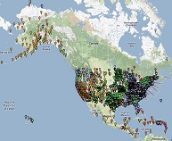
After an 8.2 magnitude earthquake off the southern coast of Alaska in late July, NGS staff are working to revise the official coordinates of NOAA Continuously Operating Reference Stations (CORS), which were significantly displaced by the earthquake. The affected stations are operated by UNAVCO, a non-profit university-governed consortium that facilitates geoscience research and education, and the Federal Aviation Administration. Both are contributors to the NOAA CORS Network (NCN), and NGS contracted with UNAVCO to conduct maintenance on NGS-owned stations and build NOAA Foundation CORS. UNAVCO is coordinating an earthquake response with geodetic community principal investigators to recover high-rate data from permanent stations, deploy campaign GNSS survey equipment, and install continuous GNSS stations. NGS manages the NCN, which provides Global Navigation Satellite System (GNSS) data, supporting 3D positioning, meteorology, space weather, and geophysical applications throughout the U.S.

For more information, contact: John Galetzka


NGS Compares Robotic Systems for Astronomical Measurements

August 13, 2021

photo of NGS training center at Corbin, VAGeodesists at the NGS Testing and Training Center in Woodford, Virginia, are testing the precision of the Total Station Astrogeodetic Control System (TSACS). TSACS directs robotic total stations to collect images of stars to measure deflections of the vertical (DOV). DOV measures how far the direction of gravity is rotated by local geographic anomalies like nearby mountains. Three different TSACS modules are performing simultaneous astronomical observations in the same location to better understand the error characteristics of the system and refine its precision, accuracy, and reliability. Measurements made by TSACS will aid geoid studies and bridge classical and modern geodetic techniques. The system will be used to detect geoid and height change in Alaska for the Geoid Monitoring Service, which measures geoid changes over time. These tests will push TSACS toward an eventual operational status, allowing NGS to regularly use robotic systems to make geodetic measurements.

For more information, contact: Ryan Hardy


U.S., Canada, and Mexico Submit Jointly Computed Geoid Model

August 6, 2021

xGEOID20The geoid is a model of global mean sea level used to measure precise surface elevations. This summer the Experimental Geoid Model 2020 (xGEOID20) - the first geoid model jointly computed by NGS, the Canadian Geodetic Survey of Natural Resources Canada, and the National Institute of Statistics and Geography of Mexico - was submitted to the International Service for the Geoid (ISG) for validation and dissemination to the scientific community. This new experimental geoid model is the culmination of years of collaboration and joint data processing between the U.S., Canada, and Mexico and heralds a new level of accuracy and interoperation among the countries' geospatial data models. The xGEOID20 covers the entire region of North America. The new model provides improved accuracy and data for navigation, positioning, and the myriad applications of geodesy, including autonomous navigation, precision agriculture, civil surveying, early warning systems, and improved floodplain mapping.

For more information, contact: Yan Wang


NGS Upgrades Geodetic Infrastructure in Manhattan

July 30, 2021

The NOAA Continuously Operating Reference Stations (CORS) Network - managed by NGS - provides Global Navigation Satellite System (GNSS) data and supports three dimensional positioning, meteorology, space weather, and geophysical applications throughout the United States. Last week, NGS Field Operations Branch staff upgraded the NGS-owned CORS station NYBP, which is located at the U.S. Coast Guard (USCG) office on the southern tip of Manhattan in Battery Park. The NGS team replaced the GNSS antenna and receiver as well as data cables, cellular modem, and back-up battery. Through careful coordination with USCG staff, and remote support from NGS CORS staff, the team was able to complete station upgrades in one day. The CORS station, which was previously offline, is now back online with modern hardware and software upgrades.

For more information, contact: Kevin Jordan


NGS Participates in International Federation of Surveyors Conference

July 02, 2021

Four NGS staff members participated in the International Federation of Surveyors (FIG) Virtual Working Week 2021. This worldwide virtual conference's theme was "Smart Surveyors for Land and Water Management - Challenges in a New Reality." NGS Director Juliana Blackwell also participated in the FIG Director Generals Forum, where attendees discussed IT governance. In five separate 90-minute sessions, NGS staff supported the efforts of the FIG Commission 5, which focuses on meeting the highest level of accuracy for positioning and measurement. These sessions raised surveyor awareness of cutting-edge technology, techniques, and procedures for using geodetic data and enhanced global cooperation and standardization in conformance with the ideals expressed by the United Nations resolution for a Global Geodetic Reference Frame.

For more information, contact: Dan Roman


NGS Identifies New Locations to Co-Locate Geospatial Technologies

June 25, 2021

The NOAA Continuously Operating Reference Stations (CORS) Network, managed by NGS, provides global navigation satellite system data, supporting three dimensional positioning, meteorology, space weather, and geophysical applications throughout the United States. NGS has identified locations to install high-quality Foundation CORS braced monuments at Very Long Baseline Array (VLBA) facilities - the VLBA is a network of 10 observing stations located across the United States. Three monuments will be installed in Pie Town, New Mexico, and another three at the National Radio Astronomy Observatory facility near Fort Davis, Texas. This is a joint project between NGS and the National Geospatial-Intelligence Agency. The plans also include the placing of radar corner reflectors to calibrate synthetic aperture radar satellites, improving the monitoring of the surface movement at and between CORS. Co-locating the Foundation CORS at the radio observatories will improve connections between space geodetic techniques, improving future realizations of the International Terrestrial Reference Frame and the accuracy of the U.S. National Spatial Reference System.

For more information, contact: John Galetzka


NGS Participates in White House Working Group

June 18, 2021

NGS presented a technical briefing in June to the White House Office of Science and Technology Policy (OSTP), describing NGS's interest in linking state-of-the-art atomic clocks over continental distances. By creating a linked network of field-portable clocks and measuring the tiny differences in their tick rates, NGS would be able to continuously monitor real-time changes in geoid height at the 1-cm level. The presentation was part of an interagency working group formed as part of a national strategy to promote quantum information science, which combines the study of information science with quantum effects in physics. By leveraging similar, aligned interests in federal agencies, the working group is working to foster the development and application of novel quantum sensors.

For more information, contact: Derek van Westrum


NGS Helps Restore Survey Benchmarks in Oahu

June 10, 2021

The NGS advisor for the Pacific region provided onsite consultation to a digital leveling crew replacing destroyed survey benchmarks on the island of Oahu, Hawaii, for the state Department of Transportation. NGS regional geodetic advisors provide expert guidance and assistance to constituents who are managing geodetic activities tied to the National Spatial Reference System (NSRS). Replacement and restoration of the destroyed survey benchmarks will strengthen the passive controls in the NSRS and improve the accuracy of NSRS data for Oahu. Consultation and guidance on geospatial and geodetic projects are available free of charge to constituents upon request.

For more information, contact: Ed Carlson


NGS Participates in Canada’s Geodesy Convocation

June 4, 2021

NGS staff attended the virtual annual meeting of the Canadian Geodetic Reference System Committee, where provincial and federal geodesists met to discuss the challenges of unifying local, national, and international reference frames, as well as emerging issues and opportunities. The NGS representative gave an update on related efforts in the United States. Collaboration with Canada and Mexico on geospatial science enables better coordination for North American commerce, engineering, transportation, and science.

For more information, contact: Joe Evjen


NGS Participates in International Young Surveyors Conference

May 28, 2021

NGS Director Juliana Blackwell gave a keynote speech at the International Federation of Surveyors’ Young Surveyors Conference, in a session for the North American region. The conference theme was "Challenges in Our New Reality: Reimagining a Sustainable Future." The event included sessions focused on four different global regions; hundreds of young surveyors attended from around the globe. NGS staff also participated in a panel discussion on overcoming challenges related to the pandemic. Participation in events like this is part of the ongoing NGS effort to serve as good stewards to the next generation of surveyors and geodesists.

For more information, contact: Jacob Heck


NGS Hosts NSRS Modernization Industry Workshop

May 21, 2021

NGS hosted 30 representatives from leading global survey equipment manufacturers and geospatial software developers for the virtual 2021 National Spatial Reference System (NSRS) Modernization Industry Workshop. This workshop is part of the NGS strategy to engage the geospatial community to enable a smooth transition to the modernized NSRS and ensure that NGS’s constituents are prepared to reap the full benefits of the new system. Improving the agency’s relationship with industry partners is key to realizing the true value of the modernized, time-dependent spatial reference system and supports sharing geospatial data to track changes over time. By working with the vendors who build the tools used by geospatial professionals, we can harness the power of crowd-sourced data collection while still maintaining our robust standards and quality control efforts.

For more information, contact: Galen Scott


NGS Hosts 2021 Geospatial Summit

May 14, 2021

NGS hosted the virtual 2021 Geospatial Summit, with more than 1,150 people attending on day one, and nearly 1,050 people attending on day two. Attendee feedback was overwhelmingly positive. Participants rated the summit's content extremely informative and the event itself extremely satisfying. The summit provided updated information on the planned modernization of the National Spatial Reference System. This modernization effort will impact federal mapping agencies, engineers, surveyors, and many other geospatial applications and user groups. Summit attendees learned how to prepare for the modernized system and how it may affect their work, asked questions of NGS experts, and shared their feedback about the planned changes. The event continued discussions from previous geospatial summits held in 2010, 2015, 2017, and 2019.

For more information, contact: Christine Gallagher


NGS Updates Guidance on Modernized National Spatial Reference System

May 7, 2021

NGS has updated the guidance it gave to geospatial professionals and engineers in three foundational documents that provide a blueprint for the modernization of the National Spatial Reference System (NSRS). Originally published from 2017 to 2019, the three volumes of Blueprint for the Modernized NSRS have all been revised to reflect an updated timeline for modernization; the Geospatial Data Act of 2018; new standards put forth by NGS and the United Nations; new technology introduced both by the geospatial industry and by NGS; and new concepts and expectations for how modernization will be implemented. Use cases have been added to part 3, which covers working in the modernized NSRS. Part 1 still covers technical and policy decisions regarding the replacement of the North American Datum of 1983, and part 2 still discusses the planned replacement of all vertical datums in the NSRS.

For more information, contact: Dru Smith


NGS Participates in Western Regional Survey Conference

April 30, 2021

Five NGS employees participated in the 2021 Western Regional Virtual Survey Conference including four NGS regional advisors and the manager for the State Plane Coordinate System of 2022 (SPCS2022). Surveyors and professionals from seven states took part in the regional conference: Alaska, Arizona, California, Montana, New Mexico, Nevada, and Washington. On the final day of the conference, NGS representatives provided presentations to a group of more than 300 attendees, speaking about SPCS2022, the modernization of the National Spatial Reference System, and the deprecation of the U.S. survey foot. Attendees were given the opportunity to comment and ask questions. The presentations were well received and attendees' questions were answered by the group.

For more information, contact: Dan Determan


NGS Briefs Alaska Senator Murkowski’s Office

April 23, 2021

NGS Director Juliana Blackwell and Alaska Regional Advisor Nic Kinsman briefed Sen. Lisa Murkowski’s staff on major programs and priorities for NGS, including modernization of the National Spatial Reference System (NSRS), its benefits to Alaska, and NGS’s role in the Alaska Coastal Mapping Strategy. The NGS representatives stressed that the NSRS is the geospatial framework for all positioning activities in the nation. They also discussed how the NSRS supports commerce and underpins resilient infrastructure. Kinsman used a current Alaska state government project to evaluate erosion risks as an example of the value of a modernized NSRS. The NSRS provides the ability to combine a multitude of geospatial datasets to assess exposure for proposed infrastructure projects, among other benefits.

For more information, contact: Nicole Kinsman


NGS OPUS Receives Record Number of Shared Observations

April 16, 2021

Citizen scientists across the U.S. used NOAA’s Online Positioning User Service (OPUS) sharing utility in record numbers this March, adding 1,649 new geodetic control observations between local surveys and the National Spatial Reference System (NSRS), the nation’s coordinate system. Historically, it took more than three years for users to share the first 3,000 observations when the utility was launched 13 years ago. At this rate, users could exceed 3,000 observations in two months. Local users have been encouraged to update observations at traditional passive control stations as part of NGS's GPS on Bench Marks campaign, which will feed geophysical models linking the nation’s current latitude, longitude, and height system to the modernized NSRS, which is coming in a few years. These crowdsourced data are crucial to achieving the NGS mission of modernizing the NSRS.

For more information, contact: Rick Foote


NGS Adds GPS Data Publishing Feature to OPUS Projects

April 9, 2021

The U.S. surveying community and citizen scientists have a new tool for anchoring local GPS surveying projects into the nationwide geodetic control network. NOAA's free Online Positioning User Service (OPUS) enables users to convert their GPS observations into precise positions. An upgrade to NGS’s OPUS Projects, coming in a few weeks, will provide an easy and efficient path to contribute GPS data to the National Spatial Reference System (NSRS) and thereby establish local survey control. This empowers local communities to create geodetic control marks, which have generally been the purview of federal geodesists. Users will be able to create geodetic control when and where they need it, with little thought to the complex data processing, quality control, archival, and display requirements. At the same time, NGS will receive more crowdsourced data and fieldwork to maintain the integrity of the NSRS.

For more information, contact: Philippe Hensel


NGS Provides Online Geodetic Digital Leveling Training

April 02, 2021

Staff at the NGS Testing and Training Center near Fredericksburg, Virginia, along with two regional geodetic advisors, provided virtual training on geodetic digital leveling. This class was previously only held in person and has been substantially redesigned for a virtual audience. This session included recorded videos of equipment setup procedures and instructions for level runs. The 28 attendees were from NOAA’s Center for Operational Oceanographic Products and Services, the U.S. Geological Survey, the Army Corps of Engineers, state departments of transportation, and private sector companies.

For more information, contact: Erika Little


NGS Provides Update to United Nations Geodetic Working Group

March 26, 2021

NGS provided an update for a working group of the United Nations (U.N.) Committee of Experts on Global Geospatial Information Management. NGS staff updated the working group for the Americas on the progress of establishing the Geodetic Reference Frame for the Americas. This update was part of the 2021 annual meeting of the Pan American Institute of Geography and History – United States National Section. In 2015, the U.N. adopted a resolution on a Global Geodetic Reference Frame for Sustainable Development, and subgroups from each region are working on reference frames in their areas.

For more information, contact: Dana Caccamise


NGS Publishes Paper on International Height Reference System

March 19, 2021

NGS scientists published a paper in the Journal of Geodesy on how to construct a global physical height system, or International Height Reference Frame (IHRF). The IHRF, which is based on the Earth's gravity field, will provide the basis for obtaining highly accurate physical heights, globally. Orthometric heights are used to calculate the direction that water flows and have many applications in mapping, engineering, and construction. The paper considers four main issues: methods to determine IHRF physical coordinates; standards and conventions needed to ensure consistency; criteria for network design and station selection; and operational infrastructure to guarantee the reliability and long-term sustainability of the IHRF.

For more information, contact: Yan Wang or Kevin Ahlgren


NGS Suppresses Height Information for Southeast Texas

March 12, 2021

As of March 2021, NGS has suppressed the publicly available height information on datasheets for southeast Texas. This region includes Beaumont, Houston, Galveston, and Rosenberg. All the survey marks in the area - except for 28 marks listed on the Southeast Texas Valid Orthometric Heights page - have had their heights suppressed. The suspect heights were removed from the top of the datasheets and listed, if specifically requested, in the superseded section. Until new surveys are completed and this new data is submitted to NGS, only the 28 marks listed are considered to have valid orthometric heights for use in mapping, surveying, construction, engineering, or other purposes. NGS continues to offer multiple opportunities to meet with regional stakeholders and discuss collaborative opportunities to collect, process, and submit updated height information.

For more information, contact: Boris Kanazir


NGS Chairs Federal Geodetic Control Subcommittee Meeting

March 5, 2021

NGS Director Juliana Blackwell chaired a meeting of the Federal Geodetic Control Subcommittee (FGCS) of the Federal Geographic Data Committee. FGCS coordinates the planning and execution of geodetic surveys, development of survey standards and specifications, and the exchange of geodetic survey data and technical information. This meeting included 28 participants from the Bureau of Ocean Energy Management, the National Geospatial-Intelligence Agency, NOAA, the National Park Service, the Department of Agriculture, and the U.S. Geological Survey (USGS). NGS provided an update on recent activities and modernization efforts. NGS and USGS presented on the Geospatial Data Act, International Organization for Standardization, and Open Geospatial Consortium standards.

For more information, contact: Brian Shaw


NGS Releases New Homepage

Febraruy 26, 2021

NGS has developed a new homepage to make it easier to find information and resources. Top tasks and frequently accessed web content have been relocated near the top of the page to make them more apparent. The new homepage is responsive and scales to different device types, including mobile, tablet, and desktop. Navigation improvements have been implemented and a rotating image carousel will provide important system updates, keep users informed of the modernization of the National Spatial Reference System, announce new NGS products and services, and promote conferences, trainings, and webinars. These changes are part of an ongoing effort to modernize the NGS website and make it more responsive to user needs and requests.

For more information, contact: Julian Inasi


NGS Creates Standard File Format to Aid Data Sharing

Febraruy 19, 2021

NGS developed a new standard file format for exchanging global navigation satellite system (GNSS) data from various survey methods and hardware from different manufacturers. Regardless of the equipment and software they use, surveyors and other geospatial professionals will be able to upload their files to NGS's OPUS Projects software for analysis, adjustment, review, and approval. The file format, called GVX (GNSS Vector Exchange), will also aid with crowdsourcing and support the GPS on Bench Marks campaign. NGS staff gave a presentation on the GVX file format to more than 30 software developers from 10 private companies, who indicated they were likely to adopt the file format and create tools in their software to import and export GVX files. Industry adoption of a standard file format for the sharing and processing of global satellite navigation data would allow for greater worldwide collaboration, data sharing, and information exchange.

For more information, contact: Dan Gillins


NGS Announces Virtual 2021 Geospatial Summit

Febraruy 12, 2021

NGS announced that its 2021 Geospatial Summit will be held online May 4-5. The Summit will provide updated information about the planned modernization of the National Spatial Reference System (NSRS). NSRS modernization will impact federal mapping agencies, engineers, surveyors, and many other geospatial applications and user groups. This Summit will continue discussions from previous Geospatial Summits held in 2010, 2015, 2017, and 2019. Topics covered at the summit will include progress in and benefits of modernizing the NSRS, and how the datum transition will impact work. Participants can also ask questions of NGS experts and share feedback about the planned changes. The event is open to the public and registration is free.

For more information, contact: Brett Howe


NGS Hosts Geospatial Modeling Grant Recipients Meeting

Febraruy 9, 2021

NGS hosted a meeting with Geospatial Modeling Grant recipients, giving NGS staff and the grant recipients the opportunity to provide updates on their respective geospatial activities and discuss potential collaboration in the future. Specific topics included workforce development in the geospatial industry, national and regional outreach plans, subsidence monitoring in the Gulf of Mexico, improving the alignment of national and regional reference frames, remote sensing technology, and gravity and astronomical observations. Meeting participants discovered and developed a list of opportunities to guide future collaborations as NGS works to modernize the National Spatial Reference System (NSRS). The funding objectives of the Geospatial Modeling Grant are to modernize and improve the NSRS in the Gulf Coast region and to improve the awareness, coordination, and use of geospatial data. Grant recipients include the University of Southern Mississippi, Texas A&M - Corpus Christi, Louisiana State University, University of Florida, and the Alabama Department of Transportation.

For more information, contact: Colin Becker


NGS Releases New Geoid Model

January 29, 2021

NGS has released its annual experimental geoid model (xGEOID) , which is the foundation for determining precise heights in the modernized National Spatial Reference System (NSRS). A geoid model approximates mean sea level as determined by the Earth's gravity field. The xGEOIDs provide preliminary - but increasingly accurate - views of the changes expected from modernizing the NSRS and replacing the North American Vertical Datum of 1988. Experimental Geoid Model 2020 (xGEOID20) is the first joint experimental geoid model produced through international cooperation among the United States, Canada, and Mexico. It incorporates the latest satellite gravity model, all available airborne gravity data from the NGS Gravity for the Redefinition of the American Vertical Datum program, and an improved digital elevation model.

For more information, contact: Yan Wang


NGS Paper Demonstrates the Accuracy of Geoid System

January 22, 2021

In a few years, NGS will modernize the nation's height system. Instead of measuring inland heights from a "mean sea level," heights will be measured relative to a constant geopotential surface known as the geoid - a model of the shape of the Earth under the influence of gravity and rotation. By providing the shape of this undulating surface everywhere, the new system will allow surveyors to use GPS receivers to determine precise heights anywhere. 

In a new paper in the Journal of Geodesy, NGS describes a test of the geoid-based system in Colorado. The test demonstrated that the system has a relative accuracy of better than 5 centimeters in mountainous terrain - a worst case scenario for geoid determination. When combined with earlier surveys in Texas and Iowa (which showed better than 2 centimeter accuracy in smoother terrain), these results indicate the new national height system will provide more accurate elevations everywhere.

For more information, contact: Derek Vanwestrum


NGS to Host International Comparison of Absolute Gravimeters

January 15, 2021

image of bipm banner, text reads Bureau International des Poids et Mesures – the intergovernmental organization through which Member States act together on matters related to measurement science and measurement standards.

NOAA's Table Mountain Gravity Observatory near Boulder, Colorado, has been selected as the host of the next International Comparison of Absolute Gravimeters (ICAG) in the summer of 2023. These comparisons, which take place every four years, are certified by the International Bureau of Weights and Measures in Sevres, France. Institutions from around the world will send representatives to confirm the consistent operation of their extremely accurate gravity instruments. The event will also include informal meetings and discussions between the visiting scientists and NOAA staff. The event will be co-organized with researchers from the National Institute of Standards and Technology. This is the first international comparison to be held in North America. The goal is to identify and correct tiny offsets in the output of these instruments. NGS uses absolute gravity measurements to help monitor long-term changes to the new vertical datum.

For more information, contact: Derek Vanwestrum


NGS Represents U.S. at International Standards Meeting

January 8, 2021

banner of International Standardization Organization (ISO) web banner.  Text reads ISO/TC211, Geographic information/Geomatics

NGS’s chief geodesist represented the U.S. at a working group meeting for the International Standardization Organization (ISO) technical committee on geographic information and geomatics. The working group discussed the replacement of the American Samoa Vertical Datum of 2002 with a local tidal datum and the adoption of GEOID18 for the U.S. mainland, Puerto Rico, and the U.S. Virgin Islands. The working group also discussed a recent publication that detailed the mission, mandate, and other details of the ISO Geodetic Registry. ISO standards provide an internationally recognized framework for the development of geodetic products and services.

For more information, contact: Dan Roman


For previous NGS weekly news stories visit the news archive.